Erfurt, Thuringia, Germany — Central Europe
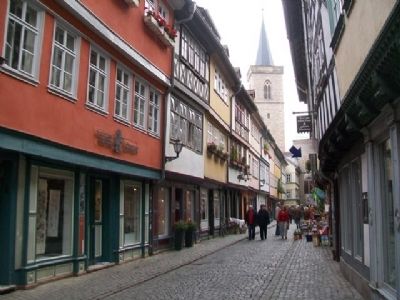
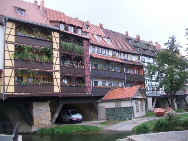
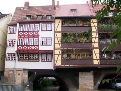
Krämerbrücke / Merchant's Bridge
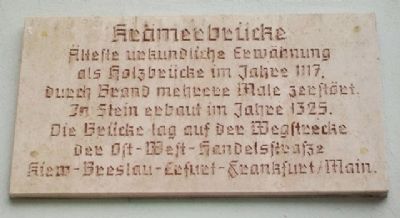
Älteste urkundliche erwähnung als holzbrücke im Jahre 1117, durch Brand mehrere Male zerstört. In Stein erbaut im Jahre 1325. Die Brücke lag auf der Wegstrecke der ost-west-handelsstrasse Kiew-Breslau-Erfurt-Frankfurt/Main.
————————
Oldest written mention of wooden bridge in 1117, destroyed by fire several times. Built in stone in 1325. The bridge was on the path of the east-west trade road Kiev-Wroclaw-Erfurt-Frankfurt/Main.
Topics. This historical marker is listed in these topic lists: Bridges & Viaducts • Industry & Commerce • Settlements & Settlers.
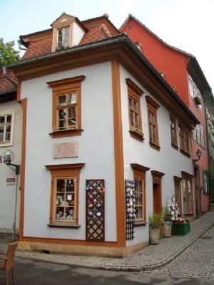
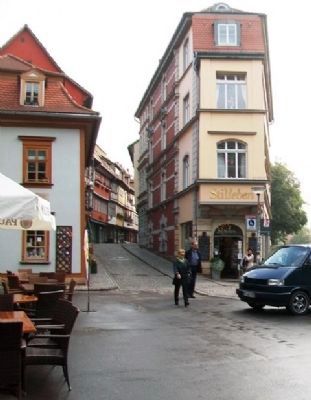
Location. 50° 58.72′ N, 11° 1.802′ E. Marker is in Erfurt, Thüringen (Thuringia). Marker is at the intersection of Krämerbrücke and Benediktsplatz, on the left when traveling east on Krämerbrücke. Touch for map. Marker is at or near this postal address: Krämerbrücke 1, Erfurt TH 99084, Germany. Touch for directions.
Other nearby markers. At least 8 other markers are within walking distance of this marker. Adam Ries (within shouting distance of this marker); [Haus] zum Schwarzen Horn / The Black Horn (within shouting distance of this marker); Fish Market 22 / Coffee Mountain House (within shouting distance of this marker); Christoph Martin Wieland (about 90 meters away, measured in a direct line); Rathaus / City Hall (about 120 meters away); Zum Güldenen Krönbacken (about 120 meters away); Laasphe-Kapelle / Laasphe Chapel (about 120 meters away); Sparkasse am Fishmarkt / Savings on Fish Market (about 120 meters away). Touch for a list and map of all markers in Erfurt.
Photographed By William Fischer, Jr., September 26, 2013
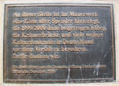
6. Krämerbrücke / Merchant's Bridge Donor Marker
Die Stadt Erfurt und die Deutsche Stiftung Denkmalschutz, Erfurt, im Dezember 2000
————————
At this point in the masonry is stored a list of all donors who in 1999/2000 helped to preserve the Krämerbrücke and many other cultural monuments in Germany before their expiration. We thank them.
The city of Erfurt and the German Foundation for Monument Protection, Erfurt, in December 2000
Credits. This page was last revised on March 20, 2024. It was originally submitted on September 9, 2014, by William Fischer, Jr. of Scranton, Pennsylvania. This page has been viewed 665 times since then and 13 times this year. Photos: 1, 2, 3, 4, 5, 6, 7. submitted on September 9, 2014, by William Fischer, Jr. of Scranton, Pennsylvania.
