Morehead City in Carteret County, North Carolina — The American South (South Atlantic)
Confederate Salt Works
Photographed by Don Morfe, August 15, 2014
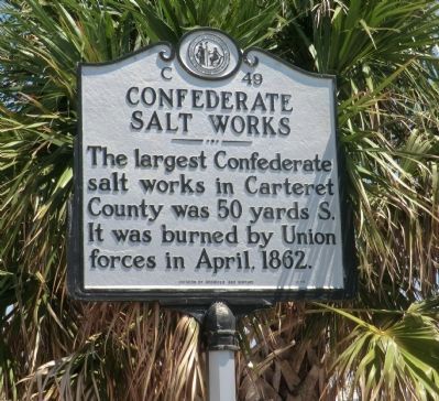
1. Confederate Salt Works Marker
The largest Confederate salt works in Carteret County was 50 yards S. It was burned by Union forces in April, 1862.
Erected 1998 by Division of Archives and History. (Marker Number C-49.)
Topics and series. This historical marker is listed in these topic lists: Industry & Commerce • War, US Civil. In addition, it is included in the North Carolina Division of Archives and History series list. A significant historical month for this entry is April 1862.
Location. 34° 43.236′ N, 76° 42.282′ W. Marker is in Morehead City, North Carolina, in Carteret County. It is at the intersection of Port Terminal Road and South 3rd Street, on the right when traveling east on Port Terminal Road. Touch for map. Marker is in this post office area: Morehead City NC 28557, United States of America. Touch for directions.

Regionally, this marker is in the Coastal Plain and on the Crystal Coast. It is also in the American South, specifically in the Upper South, in the Tidewater, and on the Eastern Seaboard. Globally, it is in the North Atlantic Region, North America, the Western Hemisphere, the Western World, and the Anglosphere.
this page online
Other nearby markers. At least 8 other markers are within 3 miles of this marker, measured as the crow flies: Atlantic Hotel (about 500 feet away, measured in a direct line); N.C. Bankers Association (about 800 feet away); Teacher's Assembly (North Carolina Education Assn.) (approx. 0.2 miles away); Fort Macon (approx. 1.9 miles away); Union Artillery (approx. 2 miles away); Jacob Henry (approx. 2.1 miles away); Remembering our Ancestors (approx. 2.1 miles away); Fort Macon Coast Guard Station (approx. 2.2 miles away). Touch for a list and map of all markers in Morehead City.
Another marker is no longer nearby. North Carolina Bankers Association (was about 800 feet away but has been replaced with another marker now near it).
Photographed by Don Morfe, August 15, 2014
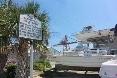
2. Confederate Salt Works Marker
Credits. This page was last revised on June 22, 2021. It was originally submitted on September 10, 2014, by Don Morfe of Baltimore, Maryland. This page has been viewed 613 times since then and 39 times this year. Photos: 1, 2. submitted on September 10, 2014, by Don Morfe of Baltimore, Maryland. • Bernard Fisher was the editor who published this page.
