Atlantic Beach in Carteret County, North Carolina — The American South (South Atlantic)
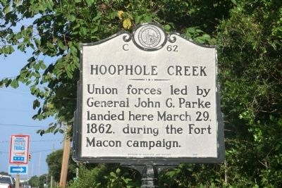
Hoophole Creek
Union forces led by General John G. Parke landed here March 29, 1862, during the Fort Macon campaign.
Erected 1986 by Division of Archives and History. (Marker Number C-62.)
Topics and series. This historical marker is listed in this topic list: War, US Civil. In addition, it is included in the North Carolina Division of Archives and History series list. A significant historical date for this entry is March 29, 2003.
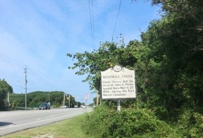
Location. 34° 41.965′ N, 76° 45.717′ W. Marker is in Atlantic Beach, North Carolina, in Carteret County. Marker is on Coral Bay Court (State Highway 58) 0.7 miles west of Atlantic Beach Causeway (County Route 1182), on the right when traveling west. Touch for map. Marker is at or near this postal address: 100 Coral Bay Ct, Atlantic Beach NC 28512, United States of America. Touch for directions.
Other nearby markers. At least 8 other markers are within 2 miles of this marker, measured as the crow flies. Hoop Pole Creek: A Coastal Nature Preserve (approx. 0.6 miles away); Hoop Pole Creek (approx. 0.6 miles away); World Trade Center (approx. 1.3 miles away); Atlantic Intracoastal Waterway (approx. 1.7 miles away); N.C. State Highway Patrol (approx. 1.8 miles away); A United States Naval Section Base Inshore Patrol (approx. 1.8 miles away); North Carolina National Guard (approx. 1.8 miles away); Carolina City (approx. 1.8 miles away). Touch for a list and map of all markers in Atlantic Beach.
Credits. This page was last revised on March 17, 2024. It was originally submitted on September 11, 2014, by Don Morfe of Baltimore, Maryland. This page has been viewed 449 times since then and 20 times this year. Last updated on June 11, 2023, by Dave W of Co, Colorado. Photos: 1, 2. submitted on September 11, 2014, by Don Morfe of Baltimore, Maryland. • J. Makali Bruton was the editor who published this page.

