Williamsville in Erie County, New York — The American Northeast (Mid-Atlantic)
Williamsville Water Mill
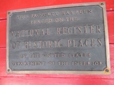
Photographed by Anton Schwarzmueller, June 17, 2014
1. Williamsville Water Mill Marker
Fixed to the front of the building.
Topics. This historical marker is listed in these topic lists: Industry & Commerce • Notable Buildings. A significant historical year for this entry is 1811.
Location. 42° 57.824′ N, 78° 44.683′ W. Marker is in Williamsville, New York, in Erie County. It is at the intersection of Spring Street and East Spring Street, on the right when traveling south on Spring Street. Spring Street is off the north side of Main Street (NY 5)near the bridge over Ellicott Creek. Touch for map. Marker is in this post office area: Buffalo NY 14221, United States of America. Touch for directions.

Regionally, this marker is in Upstate New York, specifically in Western New York, and in the Buffalo Metropolitan Area. It is also in the American Northeast and in the Mid-Atlantic. Globally, it is in North America, on the Great Lakes, in the Western Hemisphere, in the Western World, and in the Anglosphere. Historically, it finds itself in what was once the Viceroyalty of New France, the Haudenosaunee (Iroquois)
this page online
Other nearby markers. At least 8 other markers are within 2 miles of this marker, measured as the crow flies: Williamsville Christian Church (about 600 feet away, measured in a direct line); 1840 Old Stone School House (approx. ¼ mile away); SS. Peter & Paul Church (approx. ¼ mile away); U. S. Barracks 1812 (approx. 0.3 miles away); Soldiers Monument (approx. 0.4 miles away); Section House (approx. half a mile away); Former Saint Mary of the Angels (approx. 0.7 miles away); War of 1812 - 150 yrs - 1962 (approx. 1.4 miles away). Touch for a list and map of all markers in Williamsville.
Also see . . .
1. Williamsville Water Mill Complex - Wikipedia. (Submitted on September 11, 2014, by Anton Schwarzmueller of Wilson, New York.)
2. Williamsville Water Mills Complex. National Register of Historic Places form, National Archives. (Submitted on September 17, 2023, by Anton Schwarzmueller of Wilson, New York.)
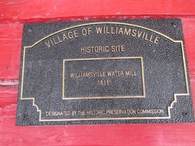
Photographed by Anton Schwarzmueller, June 17, 2014
2. Williamsville Water Mill Plaque
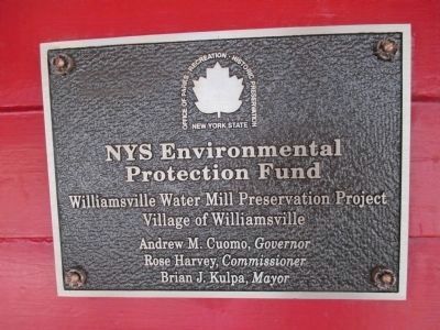
Photographed by Anton Schwarzmueller, June 17, 2014
3. Williamsville Water Mill NY State Environmental Protection Fund Plaque
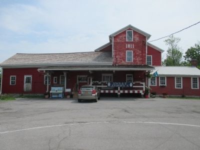
Photographed by Anton Schwarzmueller, June 17, 2014
4. Williamsville Water Mill Marker
Front. Markers by center door on porch.
Photographed by Anton Schwarzmueller, June 17, 2014
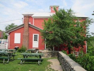
5. Williamsville Water Mill
Right side
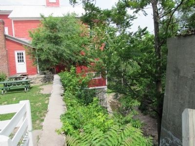
Photographed by Anton Schwarzmueller, June 17, 2014
6. Williamsville Water Mill
Right side showing the cliff.
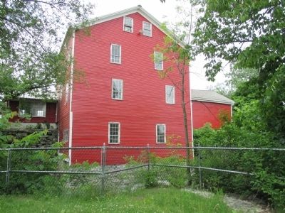
Photographed by Anton Schwarzmueller, June 17, 2014
7. Williamsville Water Mill
This side faces Glen Park, next to Glen Falls, Ellicott creek.
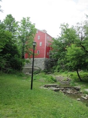
Photographed by Anton Schwarzmueller, June 17, 2014
8. Williamsville Water Mill
View from Glen Park showing the sloping ground.
Photographed by Anton Schwarzmueller, June 17, 2014
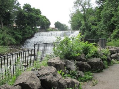
9. Glen Falls
Viewed from Glen Park, southward. Water was diverted from the falls to the mill, situated off to the right.

Photographed by Stephen Abbey, October 23, 2023
10. Glen Falls within Gleen Park; looking southward (towards Main Street/NY Route 5)
Note that an earlier sawmill (subsequently destroyed in a fire), was located on the east bank of the creek (ie: left side of this image). Jonas Williams constructed the 1811 water mill to replace the earlier sawmill.
Credits. This page was last revised on February 19, 2026. It was originally submitted on September 11, 2014, by Anton Schwarzmueller of Wilson, New York. This page has been viewed 1,040 times since then and 72 times this year. Photos: 1, 2, 3, 4, 5, 6, 7, 8, 9. submitted on September 11, 2014, by Anton Schwarzmueller of Wilson, New York. 10. submitted on February 17, 2026, by Stephen Abbey of Williamsville, New York. • Bill Pfingsten was the editor who published this page.
