Fort Lee in Bergen County, New Jersey — The American Northeast (Mid-Atlantic)
Musketry Breastwork
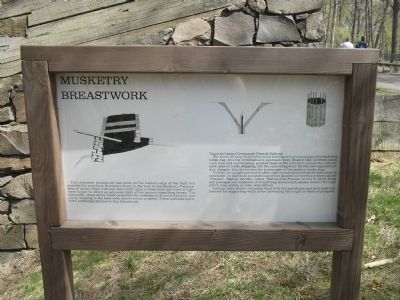
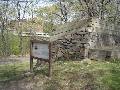
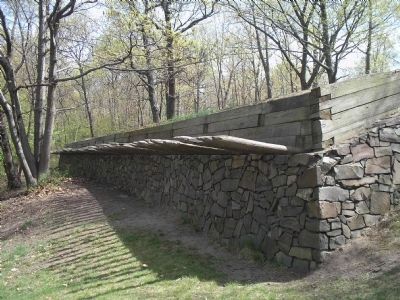
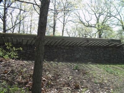
This defensive breastwork was built on the western edge of the bluff and guarded the road from Burdette’s Ferry to the west (to the Bastion). The parapets of timber filled with soil were built upon a stone base and were sufficient height to afford an adequate field of fire against assaulting troops. The banquette, (step) on the inside permitted the defenders to fire over the wall, and yet by stepping to the back were able to reload in safety. Fraise and abatis provided additional defense to this breastwork.
Trous-de-Loup, Chevaux-de-Fris & Gabions
The trous-de-loup (wolf holes) was a snaring device consisting of six-foot deep holes dug into the fortification’s approach field. Shaped like inverted cones, each hole had a protruding, pointed stake at the bottom to impale the unfortunate, man or horse, stepping into the camouflaged pit. Mostly used against cavalry charges, this device was the forerunner of the modern booby trap.
Pickets, or upright poles were often used on outside walls and formed a sort of stockade. In addition pointed logs when placed horizontally were called “Fraises”. Special devices, called “Chevaux-de-Fraises, served to block holes and passages and consisted of 12-foot long and six inch square timbers through which long spikes, or rods, were driven.
Gabions were wicker cylinders filled with dirt and stones and were used like fascines for supporting walls or for increasing the height or depth or parapets.
Erected by Fort Lee Historic Park.
Topics. This historical marker is listed in these topic lists: Forts and Castles • Notable Places • War, US Revolutionary.
Location. 40° 50.929′ N, 73° 57.852′ W. Marker is in Fort Lee, New Jersey, in Bergen County. Marker is in Fort Lee Historic Park on a walking trail to the south of the Visitor Center. Touch for map. Marker is in this post office area: Fort Lee NJ 07024, United States of America. Touch for directions.
Other nearby markers. At least 8 other markers are within walking distance of this marker. Abatis Construction at Fort Lee (within shouting distance of this marker); Soldier Hut (within shouting distance of this marker); The Barbette Battery (within shouting distance of this marker); Military Magazine (about 500 feet away, measured in a direct line); Historical Chronology 1776 (about 500 feet away); The American Crisis (about 500 feet away); Cannons (about 500 feet away); Mortar Battery (about 600 feet away). Touch for a list and map of all markers in Fort Lee.
More about this marker. The marker contains illustrations of various parts of the breastwork, including a cross section of the fortification, a trous-de-loup and a gabion.
Related markers. Click here for a list of markers that are related to this marker. This series of markers follows the walking tour of Fort Lee Historic Park.
Also see . . . Battle of Fort Washington. American Revolutionary War website entry (Submitted on August 30, 2021, by Larry Gertner of New York, New York.)
Credits. This page was last revised on August 30, 2021. It was originally submitted on May 15, 2008, by Bill Coughlin of Woodland Park, New Jersey. This page has been viewed 1,831 times since then and 34 times this year. Photos: 1, 2, 3, 4. submitted on May 15, 2008, by Bill Coughlin of Woodland Park, New Jersey. • Christopher Busta-Peck was the editor who published this page.


