Upper Merion Township near Valley Forge in Montgomery County, Pennsylvania — The American Northeast (Mid-Atlantic)
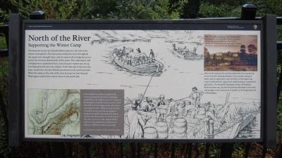
North of the River
Supporting the Winter Camp
The land just across the Schuylkill River played a vital role in the winter encampment. Provisions and armaments from throughout the region were brought there, and the army built a bridge for access across the river just downstream of this point. The commissary and a hospital were established there, and a farmers’ market was set up to sell goods and food to the soldiers. From that side of the river, the army could better monitor British movements to the north and east. When the camp on this side of the river became too foul General Washington ordered the army to move to the north side.
After the Revolution, the area flourished with the introduction of new scientific farming methods. Crop rotation, liming of fields, manure application, and cultivation of soil-improving crops transformed the region from small farming to commercial agriculture. The Schuylkill Navigation Canal, the Reading Railroad below you, and the Pennsylvania Railroad on the north side brought a vital connection to markets in the burgeoning city of Philadelphia.
(captions)
(lower left) After nearly six month’s occupation, the army’s encampment became increasingly unhealthy as hot weather came on. On June 9, Washington ordered the army to move out of their huts to fresh campgrounds with “good air and good water.” While most of the army camped in front of the old encampment. Sergeant Jeremiah Greenman from Rhode Island wrote that on June 10 “at the beat of the Genl. struck our tents. marcht about a mild over Schoolkills River & Piched our tents in a field in providance town Ship.” Archibald Robertson Maps, The New York Public Library.
(upper right) This 19th century painting of the Pawling Farm was made at a point just east of here and shows what a successful enterprise it was. Fertile meadows stretched from the barn (still standing) and house (now a ruin) to the Schuylkill River.
Erected by Valley Forge National Historical Park.
Topics and series. This historical marker is listed in this topic list: War, US Revolutionary. In addition, it is included in the Former U.S. Presidents: #01 George Washington series list. A significant historical month for this entry is June 1937.
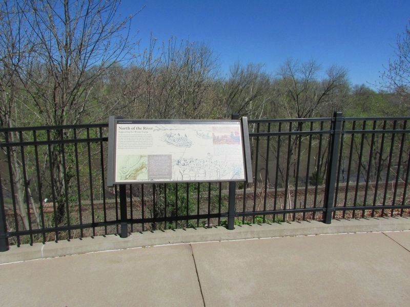
Location. 40° 6.16′ N, 75° 27.532′ W. Marker is near Valley Forge, Pennsylvania, in Montgomery County. It is in Upper Merion Township. Marker can be reached from Valley Forge Park Road (Pennsylvania Route 23) 0.3 miles east of Gulph Road (Pennsylvania Route 3031), on the left when traveling east. Touch for map. Marker is in this post office area: King of Prussia PA 19406, United States of America. Touch for directions.
Other nearby markers. At least 8 other markers are within walking distance of this marker. Why Valley Forge? (within shouting distance of this marker); Washington’s Headquarters (within shouting distance of this marker); Delaware Monument (about 300 feet away, measured in a direct line); Remembering Valley Forge (about 400 feet away); Commander in Chief’s Guards (about 400 feet away); Did You Know? (about 600 feet away); Headquarters Complex (about 700 feet away); War Comes to Valley Forge (about 700 feet away). Touch for a list and map of all markers in Valley Forge.
Also see . . . Valley Forge National Historical Park. National Park Service (Submitted on September 14, 2014.)
Credits. This page was last revised on February 7, 2023. It was originally submitted on September 14, 2014, by Bernard Fisher of Richmond, Virginia. This page has been viewed 441 times since then and 19 times this year. Photos: 1. submitted on September 14, 2014, by Bernard Fisher of Richmond, Virginia. 2. submitted on April 17, 2019, by Bill Coughlin of Woodland Park, New Jersey. 3. submitted on September 14, 2014, by Bernard Fisher of Richmond, Virginia.


