Tonganoxie in Leavenworth County, Kansas — The American Midwest (Upper Plains)
The Congregational Church of Tonganoxie
Photographed by William Fischer, Jr., August 2, 2014
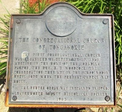
1. The Congregational Church of Tonganoxie Marker
The First Congregational Church was organized on September 23, 1868, meeting in the home of the founding pastor, the Rev. H. E. Woodcock. The congregation then met in the schoolhouse until 1872 when the present church was built.
The Reuter organ was installed in 1948.
Erected 1983 by Leavenworth County Historical Society.
Topics. This historical marker is listed in this topic list: Religion & Religious Structures. A significant historical month for this entry is September 1780.
Location. 39° 6.571′ N, 95° 5.395′ W. Marker is in Tonganoxie, Kansas, in Leavenworth County. It is at the intersection of 4th Street and Shawnee Street, on the right when traveling west on 4th Street. Touch for map. Marker is at or near this postal address: 303 East 4th Street, Tonganoxie KS 66086, United States of America. Touch for directions.

Regionally, this marker is in Eastern Kansas and specifically in Greater Kansas City. It is also in the American Midwest, in the Lewis & Clark Corridor, in the Corn Belt, on the prairies, and on the Southern Plains. Globally, it is in North America, the Western Hemisphere, the Western World, and
this page online
Other nearby markers. At least 8 other markers are within 12 miles of this marker, measured as the crow flies: Lawrence and the Old Trails (approx. 6.8 miles away); Veterans Memorial (approx. 8.7 miles away); City Hall Bell (approx. 8.7 miles away); Kansas River Flood Levels (approx. 10.7 miles away); Veterans of Foreign Wars War Memorial (approx. 11 miles away); To Our Hero Dead in World War II (approx. 11.1 miles away); 4 East 7th Street (approx. 11.3 miles away); Eudora's First Bell (approx. 11.3 miles away).
Photographed by William Fischer, Jr., August 2, 2014
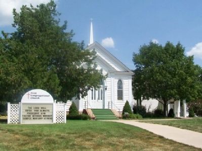
2. The Congregational Church of Tonganoxie and Marker
Credits. This page was last revised on January 20, 2021. It was originally submitted on September 15, 2014, by William Fischer, Jr. of Reynoldsburg, Ohio. This page has been viewed 567 times since then and 33 times this year. Photos: 1, 2. submitted on September 15, 2014, by William Fischer, Jr. of Reynoldsburg, Ohio.
