Weston in Platte County, Missouri — The American Midwest (Upper Plains)
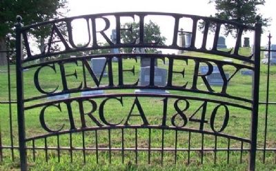
Laurel Hill Cemetery
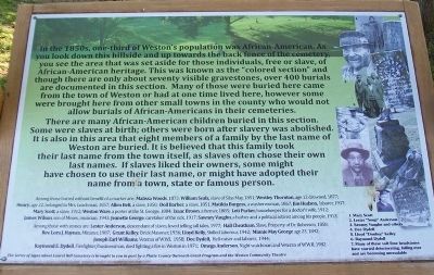
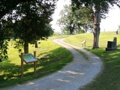
In the 1850s, one-third of Weston’s population was African-American. As you look down this hillside and up towards the back fence of the cemetery, you see the area that was set aside for those individuals, free or slave, of African-American heritage. This was known as the “colored section” and though there are only about seventy visible gravestones, over 400 burials are documented in this section. Many of those [who] were buried here came from the town of Weston or had at one time lived here, however some were brought here from other small towns in the county who would not allow burials of African-Americans in their cemeteries.
There are many African-American children buried in this section. Some were slaves at birth; others were born after slavery was abolished. It is also in this area that eight members of a family by the last name of Weston are buried. It is believed that this family took their last name from the town itself, as slaves often chose their own last names. If slaves liked their owners, some might have chosen to use their last name, or might have adopted their name from a town, state or famous person.
Among those buried without benefit of a marker are: Malissa Wood, 1873; William Seals, slave of Silas May, 1851; Westley Thornton, age 12 drowned, 1877; Henry, age 22, belonged to Mrs. Leachman, 1857; Allen Belt, a slave, 1850; Doll Barber, a slave, 1851; Matilda Burgess, a washerwoman, 1867; Jim Hudson, laborer, 1937; Mary Scott, a slave, 1912; Weston Ware, a porter at the St. George, 1884; Isaac Brown, a farmer, 1885; Lett Parker, housekeeper for a doctor’s wife, 1912; James Wilson, son of Moses, musician, 1943; Jeanette George, caretaker of the sick, 1917; Sawney Vaughn, a barber and a political activist among his people, 1913.
Among those with stones are: Lester Anderson, descendant of slaves, loved telling tall tales, 1977; Hall Cheatham, Slave, Property of Dr. Roberson, 1858; Rev. Lora J. Haynes, Minister, 1987; Grant Kelley, Brick Masoner, 1936; Lloyd Kelly, Skilled laborour [sic], 1942; Minnie May George age 23, 1892; Joseph Earl Williams, Veteran of W.W.I, 1958; Dee Dydell, Hell-raiser and laborer, 1944; Raymond E. Dydell, Firefighter/businessman, died fighting a fire in Weston in 1971; Omega Anderson, Night watchman and Veteran of W.W.II, 1982.
[Inset photo captions, from top right to bottom right, read]
1. Mary Scott
2. Lester “Soup” Anderson
3. Sawney Vaughn and others
4. Dee Dydell
5. Lloyd
“Donkey” Kelley
6. Raymond Dydell
7. Many of these soft lime headstones have started deteriorating, falling over and are becoming unreadable
Erected 2014 by Platte County Outreach Grant Program and the Weston Community Theatre.
Topics. This historical marker is listed in these topic lists: African Americans • Cemeteries & Burial Sites • Patriots & Patriotism • Settlements & Settlers. A significant historical year for this entry is 1873.
Location. 39° 24.897′ N, 94° 53.856′ W. Marker is in Weston, Missouri, in Platte County. Marker is along the road through the cemetery, off Welt Street. Touch for map. Marker is in this post office area: Weston MO 64098, United States of America. Touch for directions.
Other nearby markers. At least 8 other markers are within walking distance of this marker. A different marker also named Laurel Hill Cemetery (a few steps from this marker); a different marker also named Laurel Hill Cemetery (a few steps from this marker); a different marker also named Laurel Hill Cemetery (within shouting distance of this marker); a different marker also named Laurel Hill Cemetery (within shouting distance of this marker); Benjamin Wood House (approx. 0.3 miles away); United Methodist Church (approx. 0.3 miles away); Cody House (approx. 0.3 miles away); Timeline of Weston History (approx. 0.3 miles away). Touch for a list and map of all markers in Weston.
Also see . . . Laurel Hill Cemetery, Weston MO. (Submitted on September 19, 2014, by William Fischer, Jr. of Scranton, Pennsylvania.)
Credits. This page was last revised on June 16, 2016. It was originally submitted on September 19, 2014, by William Fischer, Jr. of Scranton, Pennsylvania. This page has been viewed 809 times since then and 64 times this year. Photos: 1, 2, 3. submitted on September 19, 2014, by William Fischer, Jr. of Scranton, Pennsylvania.


