Fort Lee in Bergen County, New Jersey — The American Northeast (Mid-Atlantic)
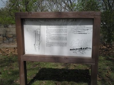
Abatis Construction at Fort Lee
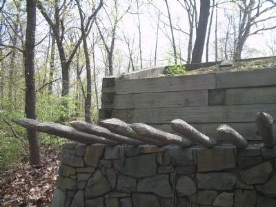
Fortifications were protected by obstacles, such as an abatis, or other major hindrances to assaulting troops. They were easily placed before a parapet, or breastwork, wherever trees were plentiful and were used to supplement defensive rampart walls or barricades.
Derived from the French word meaning heap of material thrown together, the abatis was built of piles of trees or large branches sharpened to a point and turned toward the enemy’s approach. They were entangled to form an impassable barrier for cavalry and infantry.
At Fort Lee, maps show than an abatis was placed to provide protection from an assault from the northwest exposure.
The use of an abatis either alone or together with other entanglements, led to an extensive tree-chopping program to supply logs for these obstructions and for battery emplacements as well as to provide timber for huts and firewood for cooking and heating.
Bastion
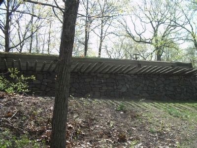
Maps show that the fortification built on the high ground to the west was rectangular in shape with bastions at each corner. It undoubtedly was built to provide additional protection to the important batteries on the bluff and to prevent their capture by a land assault.
Erected by Fort Lee Historic Park.
Topics. This historical marker is listed in these topic lists: Forts and Castles • War, US Revolutionary.
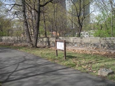
Location. 40° 50.943′ N, 73° 57.845′ W. Marker is in Fort Lee, New Jersey, in Bergen County. Marker is in Fort Lee Historic Park on a walking trail to the south of the Visitor Center. Touch for map. Marker is in this post office area: Fort Lee NJ 07024, United States of America. Touch for directions.
Other nearby markers. At least 8 other markers are within walking distance of this marker. Musketry Breastwork (within shouting distance of this marker); Soldier Hut (within shouting distance of this marker); The Barbette Battery (within shouting distance of this marker); Military Magazine (about 400 feet away, measured in a direct line); The American Crisis (about 400 feet away); Mortar Battery (about 500 feet away); Historical Chronology 1776 (about 600 feet away); Cannons (about 600 feet away). Touch for a list and map of all markers in Fort Lee.
More about this marker. The left side of the map contains a map showing the location of Fort Lee and of the fortification on the Bluff Rock.
The right side of the marker has pictures of downed trees used in constructing fortifications, and of the completed, barricaded fort.
Related markers.
Click here for a list of markers that are related to this marker. This series of markers follows the walking tour of Fort Lee Historic Park.
Also see . . . Battle of Fort Washington. American Revolutionary War website entry (Submitted on August 30, 2021, by Larry Gertner of New York, New York.)
Credits. This page was last revised on August 30, 2021. It was originally submitted on May 16, 2008, by Bill Coughlin of Woodland Park, New Jersey. This page has been viewed 3,450 times since then and 18 times this year. Photos: 1, 2, 3, 4. submitted on May 16, 2008, by Bill Coughlin of Woodland Park, New Jersey. • Kevin W. was the editor who published this page.


