Norwood in Stanly County, North Carolina — The American South (South Atlantic)
Fight at Colson's
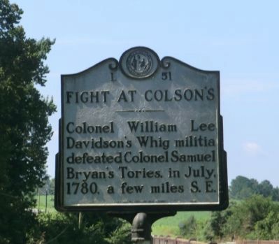
Photographed by Don Morfe, August 19, 2014
1. Fight at Colson's Marker
Erected 1952 by Division of Archives and History. (Marker Number L-51.)
Topics and series. This historical marker is listed in this topic list: War, US Revolutionary. In addition, it is included in the North Carolina Division of Archives and History series list. A significant historical month for this entry is July 1780.
Location. 35° 11.694′ N, 80° 6.771′ W. Marker is in Norwood, North Carolina, in Stanly County. It is at the intersection of U.S. 52 and Riverview Road (County Route 1934), on the right when traveling north on U.S. 52. Touch for map. Marker is in this post office area: Norwood NC 28128, United States of America. Touch for directions.

Regionally, this marker is in North Carolina’s Piedmont. It is also in the American South and specifically in the Upper South. Globally, it is in North America, the Western Hemisphere, the Western World, and the Anglosphere. Historically, it finds itself in what was once the territory of the Mississippian Culture, one of the original Thirteen Colonies,
this page online
Other nearby markers. At least 8 other markers are within 7 miles of this marker, measured as the crow flies: Randall's United Methodist Church (approx. 5.2 miles away); Carolina Female College, 1850-67 (approx. 6.3 miles away); O.C. Bruton Store (approx. 6.4 miles away); A.S. McRae Building (approx. 6.4 miles away); Zion United Methodist Church (approx. 6.4 miles away); Williams Barber Shop (approx. 6.4 miles away); Ross & Ingram Grocery (approx. 6.4 miles away); Haywood Motor Company (approx. 6.4 miles away).
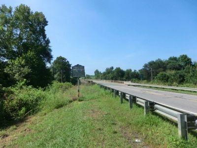
Photographed by Don Morfe, August 19, 2014
2. Fight at Colson's Marker
Credits. This page was last revised on July 2, 2021. It was originally submitted on September 22, 2014, by Don Morfe of Baltimore, Maryland. This page has been viewed 1,110 times since then and 39 times this year. Photos: 1, 2. submitted on September 22, 2014, by Don Morfe of Baltimore, Maryland. • Bernard Fisher was the editor who published this page.
