Trumbull in Fairfield County, Connecticut — The American Northeast (New England)
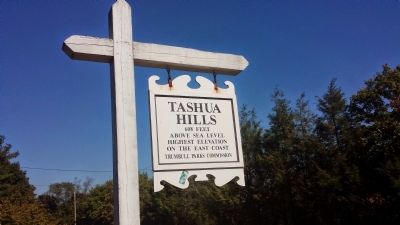
Tashua Hills
608 Feet
Above Sea Level
Highest Elevation
On the East Coast
Trumbull Parks Commission
Topics. This historical marker is listed in this topic list: Natural Features.
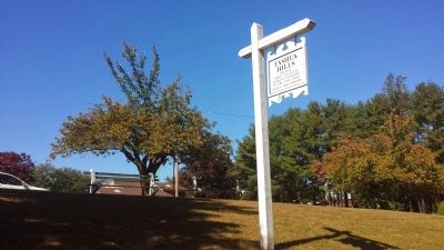
Location. 41° 15.65′ N, 73° 14.987′ W. Marker is in Trumbull, Connecticut, in Fairfield County. Marker is on Merrimac Drive, 0.2 miles north of Hills Point Rd., on the left when traveling north. Marker is on grass area at turnoff area on Merrimac Drive, across from driveway of 126 Merrimac Drive. Touch for map. Marker is at or near this postal address: 126 Merrimac Drive, Trumbull CT 06611, United States of America. Touch for directions.
Other nearby markers. At least 8 other markers are within 3 miles of this marker, measured as the crow flies. Jonathan Trumbull (approx. 1.6 miles away); Trumbull Veterans Memorial (approx. 1.6 miles away); Trumbull World War I Memorial (approx. 1.6 miles away); Long Hill World War I Memorial (approx. 1.6 miles away); Salute to Women – Veterans Day 1999 (approx. 1.6 miles away); The Trumbull Library (approx. 1.7 miles away); In Memory of Lt. Rodney L. Stokes and Sgt. Julius G. Skyberg (approx. 2.1 miles away); Easton World War II & Korean War Monument (approx. 2˝ miles away). Touch for a list and map of all markers in Trumbull.
More about this marker. Marker is a wooden sign, with the same text on both sides
Credits. This page was last revised on June 16, 2016. It was originally submitted on September 27, 2014, by Mark R Lewis of Shelton, Connecticut. This page has been viewed 1,340 times since then and 115 times this year. Photos: 1, 2. submitted on September 27, 2014, by Mark R Lewis of Shelton, Connecticut. • Bill Pfingsten was the editor who published this page.

