
Old West Lawrence in Douglas County, Kansas — The American Midwest (Upper Plains)
Buford M. Watson Jr. Park
Photographed by William Fischer, Jr., August 2, 2014
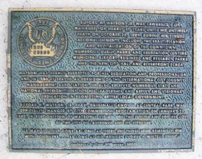
1. Buford M. Watson Jr. Park Marker
Watson was highly respected for his dedication and professionalism and in 1986-87 served as president of the International City/County Management Association. He also received numerous state and national recognitions for his leadership and active and visionary dedication in promoting better local government.
Buford M. Watson, Jr. Park, originally known as Central park, was officially changed by City Commission Proclamation on January 23, 1990, in recognition of Watson's vision for the future and for his love of the City of Lawrence and its citizens.
"A man is never gone as long as there are those who remember him with fondness...as long as his memory evokes a wistful smile."
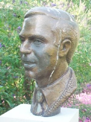
Sculpture by Tom Wilkerson, 2003
Erected by City of Lawrence.
Topics. This historical marker
this page online
Location. 38° 58.302′ N, 95° 14.316′ W. Marker is in Lawrence, Kansas, in Douglas County. It is in Old West Lawrence. It is on Kentucky Street north of 7th Street, on the left when traveling north. Touch for map. Marker is in this post office area: Lawrence KS 66044, United States of America. Touch for directions.

Regionally, this marker is in Eastern Kansas and specifically in Bleeding Kansas Border War Country. It is also in the American Midwest, in the Corn Belt, on the prairies, on the Southern Plains, and on the Santa Fe Trail Corridor. Globally, it is in North America, the Western Hemisphere, the Western World, and the Anglosphere. Historically, it finds itself in what was once the Louisiana Purchase.
Other nearby markers. At least 8 other markers are within walking distance of this marker: Santa Fe Steam Locomotive 1073 (within shouting distance of this marker); Lawrence (about 600 feet away, measured in a direct line); Historic Pinckney Neighborhood (about 600 feet away); Free State Hotel (about 700 feet away);
via Lawrence KS, unknown
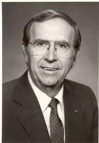
2. Buford M. Watson Jr.
Also see . . .
1. Buford M. Watson Jr. Lawrence, Kansas website entry (Submitted on September 29, 2014, by William Fischer, Jr. of Reynoldsburg, Ohio.)
2. Buford M. Watson Jr. Park. Lawrence, Kansas website entry (Submitted on September 29, 2014, by William Fischer, Jr. of Reynoldsburg, Ohio.)
Photographed by William Fischer, Jr., August 2, 2014
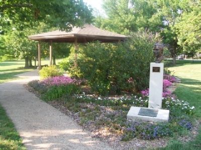
3. Buford M. Watson Jr. Park and Marker
Photographed by William Fischer, Jr., August 2, 2014
4. Buford M. Watson Jr. Bust at Watson Park
Credits. This page was last revised on December 9, 2025. It was originally submitted on September 29, 2014, by William Fischer, Jr. of Reynoldsburg, Ohio. This page has been viewed 901 times since then and 37 times this year. Photos: 1. submitted on September 29, 2014, by William Fischer, Jr. of Reynoldsburg, Ohio. 2. submitted on December 9, 2025, by Larry Gertner of New York, New York. 3, 4. submitted on September 29, 2014, by William Fischer, Jr. of Reynoldsburg, Ohio.
