Gerolzhofen in Schweinfurt, Bavaria, Germany — Central Europe
The Former Adminstrative Building
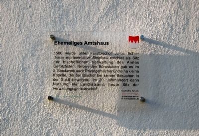
Ehemaliges Amtshaus
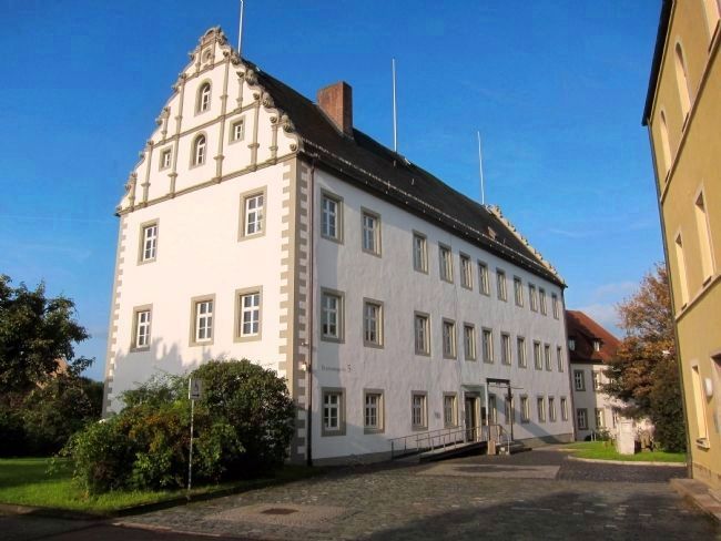
1580 wurde unter Fürstbischof Julius Echter dieser repräsentative Steinbau errichtet als Sitz der bischöflichen Verwaltung des Amtes Gerolzhofen. Neben den Bürostuben gab es im 2. Stockwerk auch Privatgemächer und eine kleine Kapelle, die der Bischof bei seinen Besuchen in der Stadt bewohnte. Im 20. Jahrhundert dann Nutzung als Landratsamt, heute Sitz der Verwaltungsgemeinschaft.
Geschichte für alle
historischer Verein in Gerolzhofen, e.V.
Dr. Ottmar Wolf - Kulturstiftung
Translated to English:
In 1580 this prestigious stone structure was built as the seat of the episcopal administrative office Office of Gerolzhofen under Prince-Bishop Julius Echter. In addition to the offices on the 2nd floor there were also private rooms and a small chapel, which inhabited by the Bishop during his visits to the city. In the 20th century it was used as District Office, and is now the seat of the township administrative office.
History for All - the Gerolzhofen Historical Society
Dr. Ottmar Wolf Cultural Foundation
Erected by The Gerolzhofen Historical Society and the Dr. Ottmar Wolf Cultural Foundation.
Topics. This historical marker is listed in this topic list: Notable Buildings. A significant historical year for this entry is 1580.
Location. 49° 54.016′ N, 10° 21.068′ E. Marker is in Gerolzhofen, Bayern (Bavaria), in Schweinfurt. Marker can be reached from Brunnengasse. Touch for map. Marker is at or near this postal address: Brunnengasse 5, Gerolzhofen BY 97447, Germany. Touch for directions.
Other nearby markers. At least 8 other markers are within walking distance of this marker. Spital Gate (within shouting distance of this marker); The Beadle’s Tower (within shouting distance of this marker); Fachwerkhaus Teutsch / Teutsch Building (within shouting distance of this marker); Prison Tower (about 90 meters away, measured in a direct line); The Decline of the Jewish Community of Gerolzhofen from January 30, 1933 (about 120 meters away); Bürgerspital / Municipal Hospital (about 120 meters away); Altes Rathaus / The Old City Hall (about 120 meters away); Spottfratze, ca. 1450 (about 150 meters away). Touch for a list and map of all markers in Gerolzhofen.
Credits. This page was last revised on January 28, 2022. It was originally submitted on October 1, 2014, by Andrew Ruppenstein of Lamorinda, California. This page has been viewed 432 times since then and 2 times this year. Photos: 1, 2. submitted on October 1, 2014, by Andrew Ruppenstein of Lamorinda, California.

