Quincy in Logan County, Ohio — The American Midwest (Great Lakes)
Old Quincy School
the Bell
Photographed by Rev. Ronald Irick, October 1, 2014
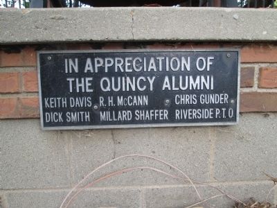
1. Old Quincy School Marker
close up of plaque
the Quincy Alumni
Keith Davis
R H McCain
Chris Gunder
Dick Smith
Millard Shaffer
Riverside P.T.O.
Erected by Riverside PTO.
Topics and series. This historical marker is listed in this topic list: Education. In addition, it is included in the Historic Bells series list.
Location. 40° 17.958′ N, 83° 58.247′ W. Marker is in Quincy, Ohio, in Logan County. It is at the intersection of South Street and Canby Street, on the left when traveling east on South Street. just east of St Rt 235. NW corner South Street and Canby Street. Touch for map. Marker is at or near this postal address: 101 South St, Quincy OH 43343, United States of America. Touch for directions.

Regionally, this marker is in Ohio’s Till Plains. It is also in the American Midwest and in the Corn Belt. Globally, it is in North America, the Western Hemisphere, the Western World, and the Anglosphere. Historically, it finds itself in what was once the Viceroyalty of New France, the Haudenosaunee (Iroquois) Confederacy, the territory of the Mississippian Culture,
this page online
Other nearby markers. At least 8 other markers are within 6 miles of this marker, measured as the crow flies: Quincy Ohio Veterans Memorial (approx. 0.7 miles away); Veterans Memorial (approx. 0.7 miles away); DeGraff, Ohio Veterans Memorial (approx. 3.4 miles away); Beehive Community Church (approx. 3.6 miles away); Vance Blockhouse (approx. 3.9 miles away); 1882 Whipple Through Truss Bridge (approx. 4 miles away); Rosewood Veterans Memorial (approx. 5.6 miles away); Asa B. Bukroker (approx. 5.6 miles away). Touch for a list and map of all markers in Quincy.
Other markers no longer nearby. Curry Blockhouse / Shawnee Village “Oldtown” (was approx. 2½ miles away but has been confirmed missing); Old Town Shawnee Village (was approx. 2½ miles away but has been confirmed missing).
Photographed by Rev. Ronald Irick, October 1, 2014
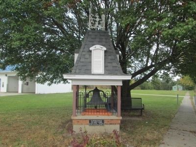
2. Old Quincy School Marker
full view
Photographed by Rev. Ronald Irick
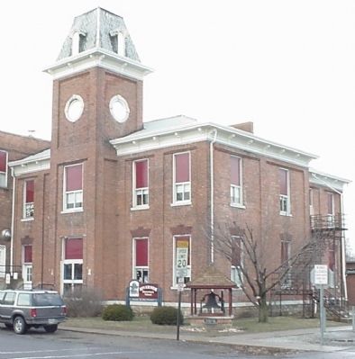
3. Old Quincy School building
scan of old picture from Archives. The roof line of the monument has been re-built to reflect the style of the old tower
Photographed by Rev. Ronald Irick, October 1, 2014
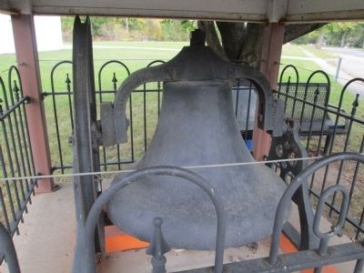
4. Old Quincy School Bell
building(s) were demolished in 2002. The bell is probably from the original building, which was replaced twice over the years.
Photographed by Rev. Ronald Irick, October 1, 2014
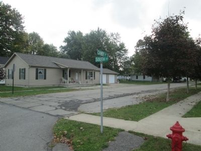
5. corner of South and Canby
street sign, across from the monument
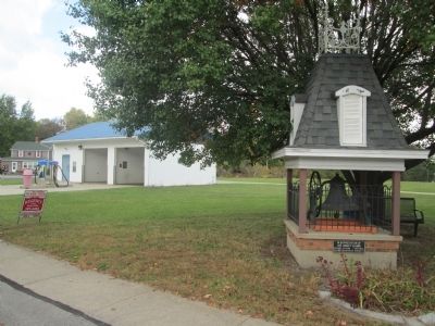
Photographed by Rev. Ronald Irick, October 1, 2014
6. Quincy School Site
a car wash now occupies the site of the former school complex
Credits. This page was last revised on June 16, 2016. It was originally submitted on October 1, 2014, by Rev. Ronald Irick of West Liberty, Ohio. This page has been viewed 1,430 times since then and 60 times this year. Photos: 1, 2, 3, 4, 5, 6. submitted on October 1, 2014, by Rev. Ronald Irick of West Liberty, Ohio. • Al Wolf was the editor who published this page.
