Walnut Cove in Stokes County, North Carolina — The American South (South Atlantic)
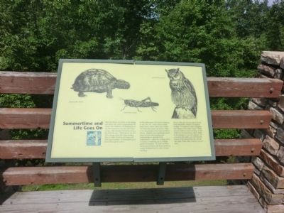
Summertime and Life Goes On
Hanging Rock State Park
As the plants grow, the insects continue to eat, eat, eat. Some insects drink plant juices, others chew into trunks and branches; many eat leaves, while some are predators that feast on fellow insects. Reptiles and amphibians spend most of their time feeding and maintain an optimal body temperature - either by cooling off in a stream or warming up in a bright patch of sunshine. In early summer, most parent birds work from sunrise to sunset finding food for their hungry nestlings.
As you relax and eat your picnic lunch, look around for evidence of animals feeding. A mushroom with a triangular bite denotes a box turtle’s lunch. Holes in leaves indicate insects feeding. A ball of hair on the forest floor, called a pellet, is the remains of an owl’s dinner. If you open the pellet, you will find the bones of the animal that the owl ate last night. What other evidence can you find? (captions)
Eastern Box Turtle; American Locust; Great Horned Owl
Erected by North Carolina State Parks.
Topics. This historical marker is listed in this topic list: Animals.
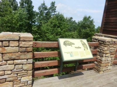
Location. 36° 23.718′ N, 80° 15.984′ W. Marker is in Walnut Cove, North Carolina, in Stokes County. Marker can be reached from Hanging Rock Park Road, 2 miles south of Moores Spring Road (County Route 1001), on the left when traveling south. The marker is located on the balcony at the Hanging Rock State Park Visitor Center. Touch for map. Marker is at or near this postal address: 1790 Hanging Rock Park Road, Walnut Cove NC 27052, United States of America. Touch for directions.
Other nearby markers. At least 8 other markers are within 4 miles of this marker, measured as the crow flies. Mountains Away From The Mountains (within shouting distance of this marker); Hanging Rock's High Flyers (within shouting distance of this marker); Rock of Ages (about 400 feet away, measured in a direct line); Lewis David von Schweinitz (approx. 2˝ miles away); Moody Tavern (approx. 3˝ miles away); Stokes County Troops C.S.A (approx. 3˝ miles away); Stokes County World War I Monument (approx. 3˝ miles away); Stoneman’s Raid (approx. 3˝ miles away). Touch for a list and map of all markers in Walnut Cove.

Photographed By Don Morfe, August 21, 2014
4. Hanging Rock State Park-Marker inside the Visitor Center
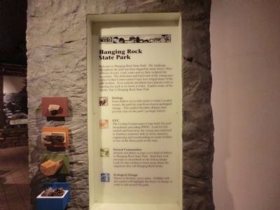
Welcome to Hanging Rock State Park! The landscape throughout the park has been shaped by many forces. Over millions of years, wind, water and ice have sculpted the mountains. The dedication and hard work of the young men in the Civilian Conservation Corps have forged many of the park facilities. Even animals and plants have played a role in molding the park as we know it today. Explore some of the wonder that is Hanging Rock State Park.
Geology-From shallow sea to lofty peaks to today’s eroded terrain, the park has experienced great geological change. This symbol identifies displays that provide clues to the park’s geologic history.
CCC-The Civilian Conservation Corps built this park immediately preceding WWII. Look for this symbol and learn how the young men stationed in Danbury mastered skills in stone masonry, engineering and woodworking to create facilities at one of the finest parks in the state.
Natural Communities-Animals and plants occupy every kind of habitat in Hanging Rock State Park-from bare rock outcrops to streambeds to the forest canopy. Look for this symbol to learn more about the organisms that call Hanging Rock home.
Ecological Change-Nature is dynamic, never static. Exhibits with this symbol will highlight the forces of change at work in and around the park.
Credits. This page was last revised on June 16, 2016. It was originally submitted on October 3, 2014, by Don Morfe of Baltimore, Maryland. This page has been viewed 380 times since then and 10 times this year. Photos: 1, 2, 3, 4. submitted on October 3, 2014, by Don Morfe of Baltimore, Maryland. • Bernard Fisher was the editor who published this page.


