Louisburg in Franklin County, North Carolina — The American South (South Atlantic)
Louisburg College
Photographed by Don Morfe, August 22, 2014
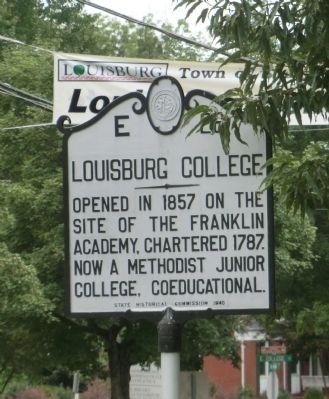
1. Louisburg College Marker
Opened in 1857 on the site of the Franklin Academy, chartered 1787. Now a Methodist Junior College, coeducational.
Erected 1940 by State Historical Commission. (Marker Number E-26.)
Topics and series. This historical marker is listed in these topic lists: Education • Religion & Religious Structures. In addition, it is included in the North Carolina Division of Archives and History series list. A significant historical year for this entry is 1857.
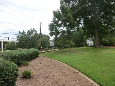
Location. 36° 6.248′ N, 78° 17.849′ W. Marker is in Louisburg, North Carolina, in Franklin County. It is on North Main Street (County Route 1229) north of College Street, on the left when traveling north. Touch for map. Marker is at or near this postal address: 501 North Main Street, Louisburg NC 27549, United States of America. Touch for directions.

Regionally, this marker is in North Carolina’s Piedmont. It is also in the American South and specifically in the Upper South. Globally, it is in North America, the Western Hemisphere, the Western World, and the Anglosphere. Historically, it finds itself in what was once the territory of the Mississippian
this page online
Other nearby markers. At least 8 other markers are within 9 miles of this marker, measured as the crow flies: Camp Site for Sherman's Army (within shouting distance of this marker); Franklin Male Academy Building (about 700 feet away, measured in a direct line); Edwin Wiley Fuller (approx. 0.3 miles away); Thomas W. Bickett (approx. half a mile away); Richard Warfington (approx. 0.6 miles away); John Williamson (approx. 0.9 miles away); Green Hill Place (approx. one mile away); Moses A. Hopkins (approx. 9 miles away). Touch for a list and map of all markers in Louisburg.
Another marker is no longer nearby. Franklin's Confederate Soldiers Monument (was a few steps from this marker but has been permanently removed).
Also see . . .
1. Louisburg College. Wikipedia entry (Submitted on January 2, 2022, by Larry Gertner of New York, New York.)
2. Louisburg College.
Louisburg College in Louisburg is recognized as the oldest chartered two-year, church-related coeducational college in the United(Submitted on February 7, 2023, by Michael Buckner of Durham, North Carolina.)States. The institution evolved from three earlier institutions. The Franklin Male Academy, which opened to students in 1805, was located on the east side of the Louisburg town commons, now part of the east side of the present college campus. In 1814 Louisburg Female Academy was chartered and was located on the west side of the town commons. By the 1850s, the school was a highly respected female seminary under the direction of Asher H. Ray and his wife, Jane Curtis Ray. The success and reputation of the Rays' seminary resulted in a movement to establish a female college in Louisburg. In January 1855, the state legislature authorized the transfer of property by the trustees of Louisburg Female Academy to the directors of Louisburg Female College Company. A four-story, 50-room brick Greek Revival building was constructed in 1857 to serve as the student dormitory, faculty living quarters, classrooms, library, dining hall, and administrative offices. Located on the west side of the current campus, "Old Main" is still in use as the administrative building of Louisburg College.Photographed by Don Morfe, August 22, 20142. Louisburg College Marker
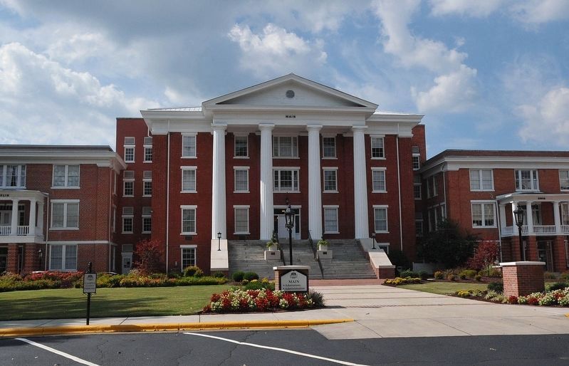
3. Louisburg College, Main Building
Credits. This page was last revised on February 8, 2023. It was originally submitted on October 11, 2014, by Don Morfe of Baltimore, Maryland. This page has been viewed 722 times since then and 27 times this year. Photos: 1, 2. submitted on October 11, 2014, by Don Morfe of Baltimore, Maryland. 3. submitted on February 7, 2023, by Michael Buckner of Durham, North Carolina. • Bernard Fisher was the editor who published this page.
