Sutton in Clay County, Nebraska — The American Midwest (Upper Plains)
Sutton
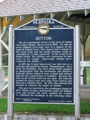
In 1871 the French homestead was laid out as a townsite and named for Sutton, Massachusetts. Soon after its founding, the town found itself engaged in disagreement with the Burlington and Missouri Railroad. Sutton wished to have a depot and offered land for the construction of facilities. Because the title to the Sutton land was not clear, the railroad located its depot some four miles from Sutton and laid out a townsite there. By 1873, the railroad had decided to relocate the depot in Sutton.
This area was hard hit by the grasshopper plague of 1874. Sutton became a distribution center for federal, state and private aid which enabled the settlers to withstand the hardships of the following winter.
Erected by Sutton Community Betterment Committee and Historical Land Mark Council. (Marker Number 49.)
Topics and series. This historical marker is listed in this topic list: Settlements & Settlers. In addition, it is included in the Nebraska State Historical Society series list. A significant historical year for this entry is 1870.
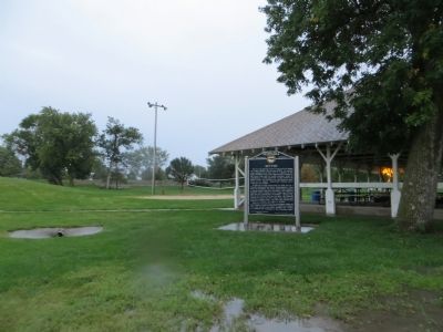
Location. 40° 36.652′ N, 97° 51.504′ W. Marker is in Sutton, Nebraska, in Clay County. Marker is on East Ash Street east of North Saunders Avenue, on the right when traveling east. Marker is in Sutton City Park. Touch for map. Marker is in this post office area: Sutton NE 68979, United States of America. Touch for directions.
Other nearby markers. At least 1 other marker is within walking distance of this marker. The Soldier's Monument (about 400 feet away, measured in a direct line).
Credits. This page was last revised on June 16, 2016. It was originally submitted on October 15, 2014, by Bill Kirchner of Tucson, Arizona. This page has been viewed 548 times since then and 15 times this year. Photos: 1, 2. submitted on October 15, 2014, by Bill Kirchner of Tucson, Arizona. 3. submitted on October 16, 2014. • Andrew Ruppenstein was the editor who published this page.


