Near Clyde in Callahan County, Texas — The American South (West South Central)
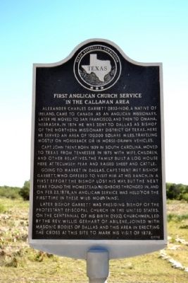
First Anglican Church Service in the Callahan Area
Photographed by Duane Hall, October 16, 2014
1. First Anglican Church Service in the Callahan Area Marker
Capt. John Trent, born 1839 in South Carolina, moved to Texas from Tennessee in 1875 with wife, children, and other relatives. The family built a log house here at Tecumseh Peak and raised sheep and cattle.
Going to market in Dallas, Capt. Trent met Bishop Garrett, who offered to visit him at his ranch. In a first effort the bishop lost his way, but the next year found the homestead. Neighbors thronged in, and on Feb. 23, 1878, an Anglican service was held for the first time in these wild mountains.
Later Bishop Garrett was presiding bishop of the Protestant Episcopal Church in the United States. On the centennial of his birth (1932), churchmen, led by the Rev. Willis Gerhart of Abilene, joined with Masonic bodies of Dallas and this area in erecting the cross at this site to mark his visit of 1878.
Erected 1976 by Texas Historical Commission. (Marker Number 2069.)
Topics. This historical marker is listed in these topic lists: Religion & Religious Structures • Settlements & Settlers. A significant historical month for this entry is February 1861.
Location. 32° 14.249′ N, 99° 36.302′ W. Marker is near Clyde, Texas, in Callahan County. It is on Farm to Market Road 1178 0.1 miles north of County Road 218, on the right when traveling north. Touch for map. Marker is in this post office area: Clyde TX 79510, United States of America. Touch for directions.

Regionally, this marker is in Big Country. Globally, it is in North America, a Gulf of Mexico
this page online
Other nearby markers. At least 8 other markers are within 12 miles of this marker, measured as the crow flies: Alexander Charles Garrett Memorial (about 300 feet away, measured in a direct line); Pioneer Physician J.D. Windham (approx. 3.4 miles away); Fletcher Ranch (approx. 5.8 miles away); Lawn Atlas ICBM Launch Site (Dyess S-6) (approx. 9 miles away); Cedar Gap Community (approx. 9.1 miles away); Taylor County (approx. 9.4 miles away); First Exploratory Oil Well in Taylor County (approx. 9.7 miles away); Jim Ned Creek (approx. 11.6 miles away).
Another marker is no longer nearby. Lytle Gap Potosi Methodist Church (was approx. 7.2 miles away but has been confirmed missing).
Photographed by Duane Hall, October 16, 2014
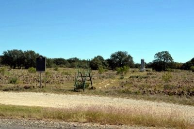
2. First Anglican Church Service in the Callahan Area Marker
Alexander Charles Garrett Memorial is located behind the marker
Photographed by Duane Hall, October 16, 2014
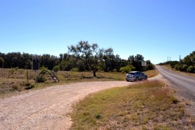
3. View to South Along Farm to Market Road 1178
Photographed by Duane Hall, October 16, 2014
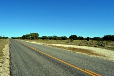
4. View to North from Farm to Market Road 1178
Credits. This page was last revised on June 16, 2016. It was originally submitted on October 17, 2014, by Duane Hall of Abilene, Texas. This page has been viewed 702 times since then and 27 times this year. Photos: 1, 2, 3, 4. submitted on October 17, 2014, by Duane Hall of Abilene, Texas.
