Plattsmouth in Cass County, Nebraska — The American Midwest (Upper Plains)
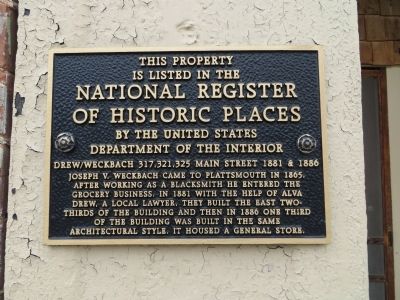
Drew/Weckbach
Photographed by Bill Kirchner, September 23, 2014
1. Drew/Weckbach Marker
is listed in the
National Register
of Historic Places
By the United States
Department of the Interior
Drew/Weckbach 317, 321, 325 Main Street 1881 & 1886
Topics. This historical marker is listed in these topic lists: Industry & Commerce • Notable Buildings. A significant historical year for this entry is 1881.
Location. 41° 0.662′ N, 95° 52.989′ W. Marker is in Plattsmouth, Nebraska, in Cass County. It is on Main Street, on the right when traveling east. Touch for map. Marker is at or near this postal address: 317 Main Street, Plattsmouth NE 68048, United States of America. Touch for directions.

Regionally, this marker is in Eastern Nebraska, in Greater Lincoln, and in Greater Omaha. It is also in the American Midwest, in the Lewis & Clark Corridor, in the Corn Belt,
this page online
Other nearby markers. At least 8 other markers are within one mile of this marker, measured as the crow flies: Excelsior Building (a few steps from this marker); Vienna Bakery (a few steps from this marker); Blake Building (within shouting distance of this marker); Wetenkamp Building (within shouting distance of this marker); Budweiser Building 1888 (within shouting distance of this marker); Cass County Courthouse (within shouting distance of this marker); Company A – First Nebraska Volunteer Infantry (approx. 0.2 miles away); Plattsmouth Bridge 1930 (approx. 1.1 miles away). Touch for a list and map of all markers in Plattsmouth.
Photographed by Bill Kirchner, September 23, 2014
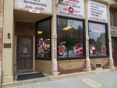
2. Drew/Weckbach Marker
Marker is at the far left.
Photographed by Bill Kirchner, September 23, 2014
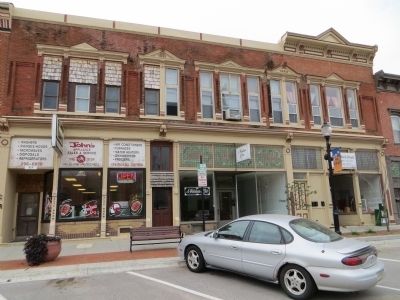
3. Drew/Weckbach Building
Credits. This page was last revised on June 16, 2016. It was originally submitted on October 17, 2014, by Bill Kirchner of Tucson, Arizona. This page has been viewed 594 times since then and 25 times this year. Photos: 1, 2, 3. submitted on October 17, 2014, by Bill Kirchner of Tucson, Arizona. • Bill Pfingsten was the editor who published this page.
