Port Wallace in Dartmouth in Halifax Region, Nova Scotia — The Atlantic Provinces (North America)
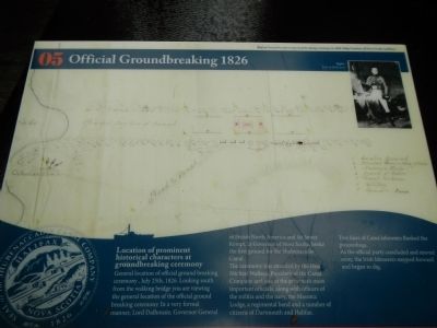
Official Groundbreaking 1829
Photographed by Barry Swackhamer, June 15, 2014
1. Official Groundbreaking 1829 Marker
General location of the official ground breaking ceremony, July 25th, 1826. Looking south from the walking bridge you are viewing the general location of the official ground breaking ceremony. In a very formal manner, Lord Dalhouse, Governor General of British North America and Sir James Kempt, Lt. Governor of Nova Scotia, broke the first ground for the Shubenacadie Canal.
The ceremony was attended by the Hon. Michael Wallace, President of the Canal Company and one of the province’s most important officials, along with officers of the militia and the navy, the Masonic Lodge, a regimental band and a number of citizens of Dartmouth and Halifax.
Two lines of Canal labourers flanked the proceedings. As the official party concluded and moved away, the Irish labourers stepped forward and began to dig.
Erected by Shubenacadie Canal Commission. (Marker Number 05.)
Topics. This historical marker is listed in this topic list: Waterways & Vessels. A significant historical date for this entry is July 25, 1831.
Location. 44° 42.144′ N, 63° 33.256′ W. Marker is
this page online

Regionally, this marker is in the Halifax Area. It is also in the Maritimes and in Atlantic Canada. Globally, it is in the North Atlantic Region, North America, the Western Hemisphere, the Western World, and the Anglosphere. Historically, it finds itself in what was once a British colony, the Viceroyalty of New France, and Acadia.
Other nearby markers. At least 8 other markers are within walking distance of this marker: Historic Shubenacadie Canal System (within shouting distance of this marker); Canal Shubenacadie Canal (within shouting distance of this marker); The Fairbanks Solution (within shouting distance of this marker); Waste Weir and Holding Pond (within shouting distance of this marker); Before the Canal (about 90 meters away, measured in a direct line); Of Bough and Bark (about 150 meters away); Navvies Dwelling (about 180 meters away); A Village of the Most Primitive Description
Photographed by Barry Swackhamer, June 15, 2014
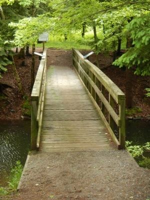
2. Official Groundbreaking 1829 Marker
The marker is on the downstream (left) railing on this bridge over the canal.
More about this marker. This marker is on the south side of the canal bridge at the south end of Shubie Park.
Credits. This page was last revised on June 16, 2016. It was originally submitted on October 18, 2014, by Barry Swackhamer of Brentwood, California. This page has been viewed 472 times since then and 17 times this year. Photos: 1, 2. submitted on October 18, 2014, by Barry Swackhamer of Brentwood, California. • Andrew Ruppenstein was the editor who published this page.
