
Port Wallace in Dartmouth in Halifax Region, Nova Scotia — The Atlantic Provinces (North America)
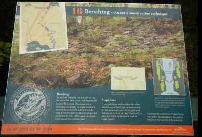
Benching - An early construction technique
Photographed by Barry Swackhamer, June 15, 2014
1. Benching - An early construction technique Marker
Captions: (insert on the left) Original design for stop gates at Port Wallace, 1829, by Francis Hall.; (insert on the right) In this model of the stop gate you can see the two swing beams mounted on the top of the two gates which can be pushed open to allow a barge or vessel to pass or closed to maintain the level of Lake Charles.
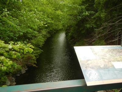
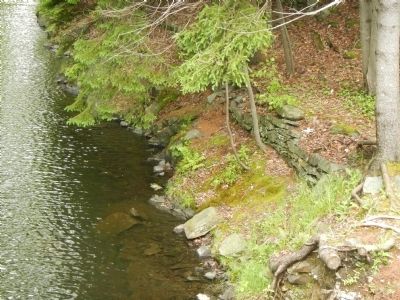
As you look down the Cut you will see, on the left or East bank, stone walls separated by narrow, flat terraces. This construction technique was used by the canal workers to prevent the earth from sliding down the bank. It was obviously an efficient construction method as the sides of the canal cut remain almost intact two centuries later.
Stop Gates
If you look below and on either side of the channel you will see large cut stones which are the remains of a mitred stop gate used to maintain the level of Lake Charles an to allow the Cut to be drained to work on Locks 2 and 3.
Control of the water level of Lake Charles was vital to the operation of the canal as this lake is the summit of the waterway.
Erected by Shubenacadie Canal Commission. (Marker Number 16.)
Topics. This historical marker is listed in this topic list: Waterways & Vessels.
Location. 44° 42.494′ N, 63° 33.257′ W. Marker is in Dartmouth, Nova Scotia, in Halifax Region. It is in Port Wallace. It can be reached from Locks Road, on the left when traveling north. Touch for map. Marker
this page online

Regionally, this marker is in Nova Scotia’s Halifax Area. It is also in the Maritimes and in Atlantic Canada. Globally, it is in the North Atlantic Region, North America, the Western Hemisphere, the Western World, and the Anglosphere. Historically, it finds itself in what was once a British colony, the Viceroyalty of New France, and Acadia.
Other nearby markers. At least 8 other markers are within walking distance of this marker: Summit of the Canal (here, next to this marker); Shubenacadie Canal, Port Wallace (within shouting distance of this marker); The Forge (about 210 meters away, measured in a direct line); One of the mysteries yet to be solved… (approx. 0.4 kilometers away); Deep Cut (approx. 0.6 kilometers away); Navvies Dwelling (approx. 0.6 kilometers away); Canal Shubenacadie Canal (approx. 0.6 kilometers away); Official Groundbreaking 1829 (approx. 0.6 kilometers away). Touch for a list and map of all markers in Dartmouth.
More about this marker. This marker is located mid-span on the bridge
Photographed by Barry Swackhamer, June 15, 2014
2. Benching - An early construction technique Marker
Photographed by Barry Swackhamer, June 15, 2014
3. Benching
Credits. This page was last revised on June 16, 2016. It was originally submitted on October 19, 2014, by Barry Swackhamer of Brentwood, California. This page has been viewed 550 times since then and 13 times this year. Photos: 1, 2, 3. submitted on October 19, 2014, by Barry Swackhamer of Brentwood, California. • Andrew Ruppenstein was the editor who published this page.
