Covington in Kenton County, Kentucky — The American South (East South Central)
Chief Little Turtle
Photographed by Rev. Ronald Irick, October 12, 2014
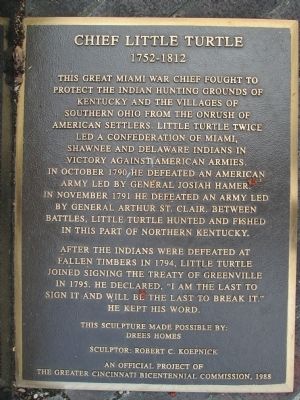
1. Chief Little Turtle Marker
I have to question the truth of part of the text; following the rout of Harmar, and the defeat of St. Clair, both armies retreated to Fort Washington (Cincinnati) I can’t see Little Turtle “hunting and fishing” just across the river. He was known to live near Ft. Wayne, Indiana during that time period.
After the Indians were defeated at Fallen Timbers in 1794, Little Turtle joined signing the Treaty of Greenville in 1795. He declared, “I am the last to sign it, and will be the last to break it.” He kept his word.
This sculpture made possible by:
Drees Homes
Sculptor: Robert C. Koepnick
Erected 1988 by An Official Project of - - The Greater Cincinnati Bicentennial Commission.
Topics. This historical marker is listed in this topic list: Indigenous Peoples and Communities. A significant historical month for this entry is October 1790.
Location. 39° 5.498′ N, 84° 30.258′ W. Marker is in Covington,
this page online

Regionally, this marker is in Kentucky’s Outer Bluegrass. It is also in the American South, specifically in the Upper South, and in the Ohio River Valley. Globally, it is in North America, the Western Hemisphere, the Western World, and the Anglosphere. Historically, it finds itself in what was once the territory of the Mississippian Culture and also the Antebellum South.
Other nearby markers. At least 8 other markers are within walking distance of this marker: John James Audubon (a few steps from this marker); James Bradley (about 400 feet away, measured in a direct line); Carneal House, ca. 1815 (about 500 feet away); Cincinnati Skyline Pre-1865 (about 600 feet away); Defending the Valley (about 600 feet away); The Civil War in Northern Kentucky (about 600 feet away); Flood Walls (about 600 feet away); A New Perspective: 1865-1900 (about 600 feet away). Touch for a list and map of all markers
Photographed by Rev. Ronald Irick, October 12, 2014
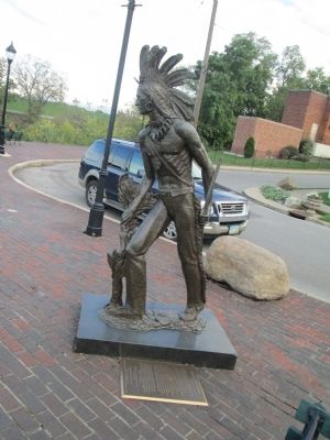
2. Chief Little Turtle Marker
full view of site
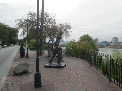
More about this marker. marker is on the “River Walk” on Riverside Dr. at Shelby Str., at the confluence of the Ohio and Licking Rivers/
Photographed by Rev. Ronald Irick, October 12, 2014
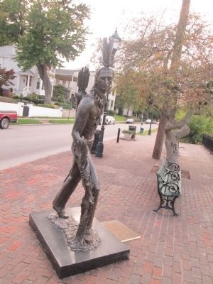
3. Chief Little Turtle statue
Photographed by Rev. Ronald Irick, October 12, 2014
4. Chief Little Turtle site
Credits. This page was last revised on June 16, 2016. It was originally submitted on October 21, 2014, by Rev. Ronald Irick of West Liberty, Ohio. This page has been viewed 2,055 times since then and 138 times this year. Photos: 1, 2, 3, 4. submitted on October 21, 2014, by Rev. Ronald Irick of West Liberty, Ohio. • Al Wolf was the editor who published this page.
