
Near Winterset in Madison County, Iowa — The American Midwest (Upper Plains)
Cedar Covered Bridge
Photographed by Bill Kirchner, September 23, 2014
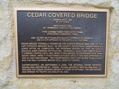
1. Cedar Covered Bridge Marker
By: H.P. Jones
Replica Built: 2004
By: Herberger Construction Company
Type: Covered Timber Town Lattice Truss
Overlaid by a Queenpost Frame
Size: 130 feet (66 ft truss with an 42.5 ft approach to the south
and a 21.5 ft approach to the north) x 13.7 feet wide
Cedar Bridge (formally known as the Casper Bridge) was one of the last covered bridges built in the county, reportedly undertaken by Jones after he completed the Roseman Bridge so that he could resolve some framing difficulties. Originally built over North River, it carried traffic until 1920, when it was moved to its present site over Cedar Creek. Here it functioned in place until it too was bypassed in 1964 by another bridge. The Cedar Bridge cost just $2,965 to build and was the only covered bridge still open to traffic.
Unfortunately, on September 3, 2002, the original Cedar Covered Bridge was destroyed by arson. In 2004, an exact replica was built to replace the Cedar Covered Bridge at a cost of $772,824. the new bridge was opened to traffic on August 23, 2004.
Topics and series. This historical marker is listed in this topic
this page online
Location. 41° 21.922′ N, 93° 59.451′ W. Marker is near Winterset, Iowa, in Madison County. It is on Cedar Bridge Road 1.8 miles north of Iowa Highway 92, on the left when traveling north. Touch for map. Marker is in this post office area: Winterset IA 50273, United States of America. Touch for directions.

Regionally, this marker is in Southern Iowa and in Greater Des Moines. It is also in the American Midwest and in the Corn Belt. Globally, it is in North America, the Western Hemisphere, the Western World, and the Anglosphere. Historically, it finds itself in what was once the territory of the Mississippian Culture and also the Louisiana Purchase.
Other nearby markers. At least 8 other markers are within 3 miles of this marker, measured as the crow flies: 101 East Jefferson (approx. 2.4 miles away); 73 Jefferson (approx. 2.4 miles away); Winterset Civil War Memorial (approx. 2.4 miles away); 71 Jefferson (approx. 2.4 miles away); 69 Jefferson (approx. 2.4 miles away); 106 East Jefferson
Photographed by Bill Kirchner, September 23, 2014
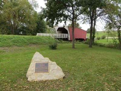
2. Cedar Covered Bridge Marker
Photographed by Bill Kirchner, September 23, 2014
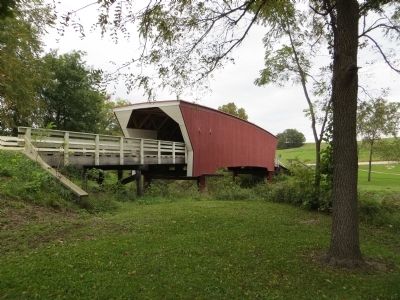
3. Cedar Covered Bridge
Photographed by Bill Kirchner, September 23, 2014
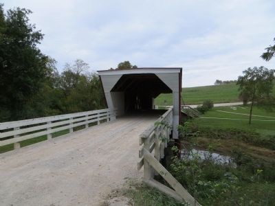
4. Cedar Covered Bridge
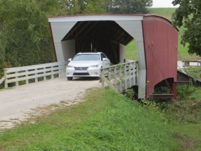
Photographed by Bill Kirchner, September 23, 2014
5. Cedar Covered Bridge
the only covered bridge still open to traffic
Credits. This page was last revised on November 22, 2023. It was originally submitted on October 22, 2014, by Bill Kirchner of Tucson, Arizona. This page has been viewed 836 times since then and 27 times this year. Photos: 1, 2, 3, 4, 5. submitted on October 22, 2014, by Bill Kirchner of Tucson, Arizona. • Andrew Ruppenstein was the editor who published this page.
