Annapolis Royal in Annapolis County, Nova Scotia — The Atlantic Provinces (North America)
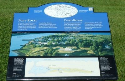
Port-Royal
Photographed by Barry Swackhamer, June 17, 2014
1. Port-Royal Marker
Port-Royal Habitation, From 1636 to 1710 the French settlement surrounding present-day Fort Anne was also called Port-Royal./ De. 1605 à 1613, l’établissement françis et poste de traite des fourrures situé sur la rive en face de l’île aux Chèvres s’appelle l’Habitation de Port-Royal. De 1636 à 1710 l’établissement français entourant l’actuel fort Anne s’appelle également Port-Royal.
When the French first came to the Annapolis Basin, Samuel de Champlain called it “Port-Royal” in recognition of its great size. Eventually, the area surrounding the basin and along the Annapolis River became known as Port-Royal.
French
Lorsque les Français arrivent pour le première fois dans le bassin de l’Annapolis, Champlain l’appelle «Port-Royal» pour souligner sa grand étendue. Par la suite, c’est la région entourant le bassin et le long de la rivière Annapolis que est appelée Port-Royal.
Topics and series. This historical marker is listed in this topic list: Settlements & Settlers. In addition, it is included in the Acadian History series list.
Location. 44° 44.521′ N, 65° 31.191′ W. Marker is in Annapolis Royal, Nova Scotia, in Annapolis County. It can be reached from St. George Street close to St. Anthony Street, on the left when traveling west. Touch for map. Marker is at or near this postal address: 323 St George Street, Annapolis Royal NS B0S 1A0, Canada. Touch for directions.

Regionally, this marker is on the Evangeline Trail.
this page online
Other nearby markers. At least 8 other markers are within walking distance of this marker: Queen’s Wharf (within shouting distance of this marker); The Flag Bastion / Le bastion de l’étendard (within shouting distance of this marker); The Black Hole / Le cachot (within shouting distance of this marker); Sieur de Monts (within shouting distance of this marker); Samuel Vetch (within shouting distance of this marker); William Wolseley (about 120 meters away, measured in a direct line); Captures of Port Royal (about 120 meters away); Daniel Auger de Subercase (about 120 meters away). Touch for a list and map of all markers in Annapolis Royal.
More about this marker. This marker is located on the grounds of Fort Anne National Historic Site.
Also see . . . Port-Royal National Historic Site of Canada - Parks Canada. While only in existence a few years, the settlement, and what it accomplished, proved to be a model for future exploration of the continent.
Photographed by Barry Swackhamer, June 17, 2014
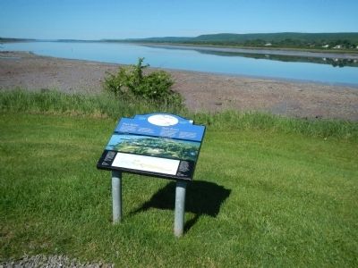
2. Port-Royal Marker
Looking in the direction of the first Port Royal settlement.
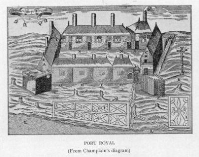
Photographed by Champlain, circa 1612
3. Champlain's diagram of Port-Royal
Credits. This page was last revised on June 16, 2016. It was originally submitted on November 1, 2014, by Barry Swackhamer of Brentwood, California. This page has been viewed 681 times since then and 30 times this year. Photos: 1, 2, 3. submitted on November 1, 2014, by Barry Swackhamer of Brentwood, California. • Andrew Ruppenstein was the editor who published this page.
