Near Searles in Brown County, Minnesota — The American Midwest (Upper Plains)
Cottonwood Twp. Evangelical Church and Cemetery
Photographed by K. Linzmeier, May 5, 2014
1. Cottonwood Twp. Evangelical Church and Cemetery Marker
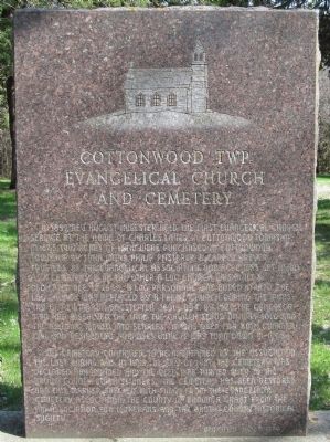
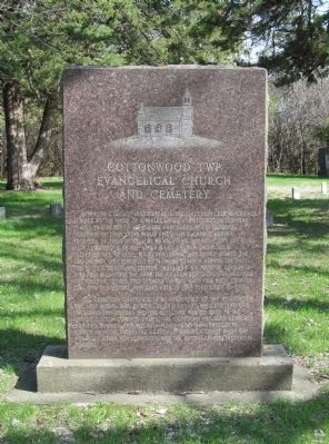
In 1857, Rev. August Huelster held the first Evangelical church service at the home of Charles Lauer in Cottonwood Township. In 1865, two acres of land were purchased in Cottonwood Township by John Mohr, Philip Pfisterer & Carl Schreyer, trustees of the Evangelical Association. One acre was set aside as a cemetery & on the other a log church was built & dedicated Dec. 19, 1869. A log parsonage was added in 1870. The log church was replaced by a frame church during the ministry of Rev. Martin Gagstetter 1891-1894. By 1920, the congregation had dissolved, the land the church stood on was sold and the building moved into Searles. It was used for both commercial and residential purposes until it was torn down in 1968.
The cemetery continued to be maintained by the association. The last burial was in 1955. In July of 1986, the cemetery was declared abandoned and the deed was turned over to the Brown County Commissioners. The cemetery has been restored and this marker erected with funds from the Evangelical Cemetery Association, the County of Brown, a grant from the Aid Association for Lutherans and the Brown
this page online
(reverse)
Photographed by K. Linzmeier, May 5, 2014
2. Cottonwood Twp. Evangelical Church and Cemetery Marker
Erected 1989 by the Evangelical Cemetery Association, the County of Brown, a grant from the Aid Association for Lutherans and the Brown County Historical Society.
Topics. This historical marker is listed in these topic lists: Cemeteries & Burial Sites • Religion & Religious Structures. A significant historical month for this entry is July 1986.
Location. 44° 14.367′ N,
Photographed by K. Linzmeier, May 5, 2014
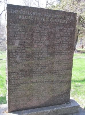
3. Reverse of Marker

Regionally, this marker is in Southwest Minnesota and specifically in the Minnesota River Valley. It is also in the American Midwest and in the Corn Belt. Globally, it is in North America, the Western Hemisphere, the Western World, and the Anglosphere. Historically, it finds itself in what was once Rupert’s Land, the territory of the Mississippian Culture, and the Louisiana Purchase.
Other nearby markers. At least 8 other markers are within 5 miles of this marker, measured as the crow flies: Searles (approx. 0.8 miles away); Father Valentine Sommereisen (approx. 2.2 miles away); Adams Park (approx. 3.4 miles away); Junior Pioneers of New Ulm and Vicinity (approx. 3.6 miles away); The Wallachei (approx. 3.8 miles away); The Evacuation of New Ulm
Photographed by K. Linzmeier, May 5, 2014
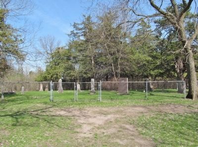
4. Cottonwood Township Cemetery and Marker
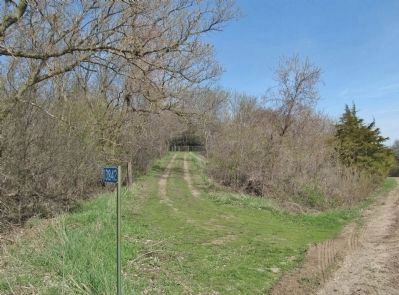
Photographed by K. Linzmeier, May 5, 2014
5. Service Road to Cemetery
Credits. This page was last revised on June 16, 2016. It was originally submitted on November 1, 2014, by Keith L of Wisconsin Rapids, Wisconsin. This page has been viewed 1,256 times since then and 50 times this year. Photos: 1, 2, 3, 4, 5. submitted on November 1, 2014, by Keith L of Wisconsin Rapids, Wisconsin.
