Near Catonsville in Baltimore County, Maryland — The American Northeast (Mid-Atlantic)
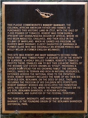
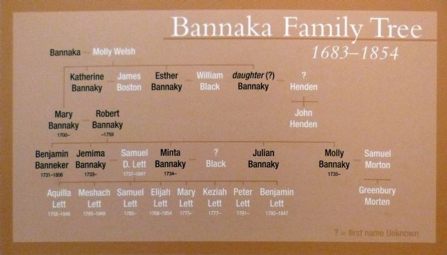
Robert Bannaky
This site was Robert and Mary Bannaky's second farm; their first was 'Timber Point', a 25-acre lot in the vicinity of Elkridge. A highly skilled farmer, Robert's tobacco profits there, enabled him to buy this 100-acre parcel of the Richard Gist estate known as 'Stout', providing a larger homestead for his growing family. The original parcel , varied in terrain and rich in natural resources, extended across the National Road to the Patapsco River. Robert Bannaky included the name of his six-year old son, Benjamin, on the deed of sale, this securing the freedom of his children into perpetuity. Robert Bannaky worked and developed the farmstead until his death in 1759, when the property passed on to his son, Benjamin Banneker, a renown[ed] author, astronomer, and surveyor of the Federal Territory.
The foresight, ingenuity, and hard work of Robert Bannaky, is the founding origin of the Benjamin Banneker Historical Park.
Topics. This historical marker is listed in these topic lists: African Americans • Agriculture. A significant historical year for this entry is 1737.
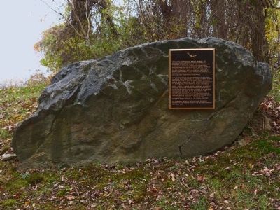
Location. 39° 16.188′ N, 76° 46.523′ W. Marker is near Catonsville, Maryland, in Baltimore County. Marker can be reached from Oella Avenue. Marker is in Benjamin Banneker Historical Park at 300 Oella Avenue. Touch for map. Marker is in this post office area: Catonsville MD 21228, United States of America. Touch for directions.
Other nearby markers. At least 8 other markers are within walking distance of this marker. Benjamin Banneker (within shouting distance of this marker); 20th Anniversary (about 300 feet away, measured in a direct line); The Stone Farmhouse (about 400 feet away); Banneker's Orchard (about 400 feet away); a different marker also named Benjamin Banneker (approx. 0.4 miles away); Edges of Earth's Crust Collided Here (approx. 0.9 miles away); The George Ellicott House (approx. one mile away); "Just One Nickel and I Could Ride" (approx. one mile away). Touch for a list and map of all markers in Catonsville.
Also see . . .
1. Wikipedia: Benjamin Banneker. (Submitted on September 7, 2015.)
2. Wikipedia: Benjamin Banneker Historical Park and Museum, Baltimore County, Maryland. (Submitted on September 7, 2015.)
Credits. This page was last revised on January 19, 2020. It was originally submitted on November 3, 2014, by Allen C. Browne of Silver Spring, Maryland. This page has been viewed 3,912 times since then and 358 times this year. Photos: 1, 2, 3, 4. submitted on November 3, 2014, by Allen C. Browne of Silver Spring, Maryland. • Bill Pfingsten was the editor who published this page.


