Lanfair Valley in San Bernardino County, California — The American West (Pacific Coastal)
Nevada Southern Railway
Photographed by Craig Baker
1. Nevada Southern Railway Marker
Inscription.
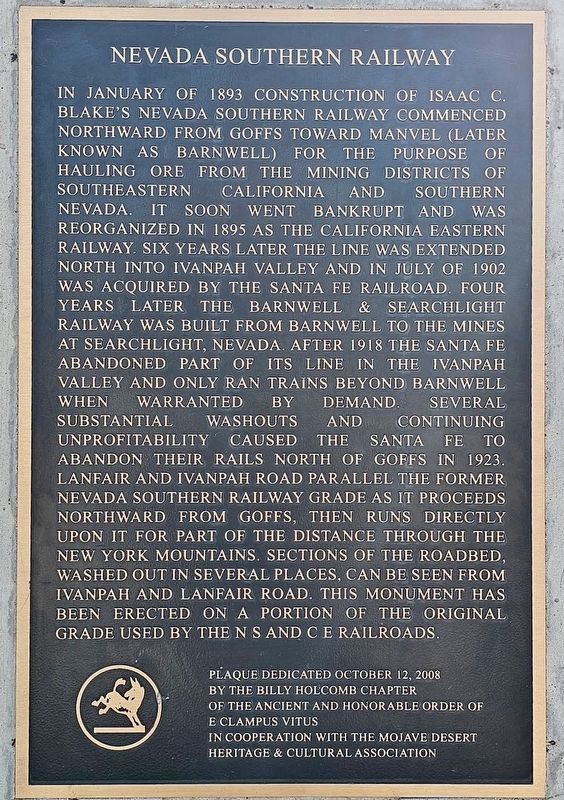
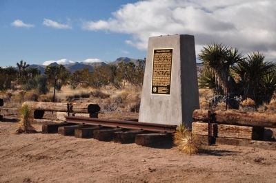
Nevada Southern Railway. . In January of 1893 construction of Isaac C. Blake's Nevada Southern Railway commenced northward from Goffs toward Manvel (later known as Barnwell) for the purpose of hauling ore from the mining districts of southeastern California and southern Nevada. It soon went bankrupt and was reorganized in 1895 as the California Eastern Railway. Six years later the line was extended north into Ivanpah Valley and in July of 1902 was acquired by the Santa Fe Railroad. Four years later the Barnwell and Searchlight Railway was built from Barnwell to the mines at Searchlight, Nevada. After 1918 the Santa Fe abandoned part of its line in the Ivanpah Valley and only ran trains beyond Barnwell when warranted by demand. Several substantial washouts and continuing unprofitability caused the Santa Fe to abandon their rails north of Goffs in 1923. Lanfair and Ivanpah Road parallel the former Nevada Southern Railway grade as it proceeds northward from Goffs, then runs directly upon it for part of the distance through the New York Mountains. Sections of the roadbed, washed out in several places, can be seen from Ivanpah and Lanfair Road. This monument has been erected on a portion of the original grade used by the NS and CE Railroads.
In January of 1893 construction of Isaac C. Blake's Nevada Southern Railway commenced northward from Goffs toward Manvel (later known as Barnwell) for the purpose of hauling ore from the mining districts of southeastern California and southern Nevada. It soon went bankrupt and was reorganized in 1895 as the California Eastern Railway. Six years later the line was extended north into Ivanpah Valley and in July of 1902 was acquired by the Santa Fe Railroad. Four years later the Barnwell & Searchlight Railway was built from Barnwell to the mines at Searchlight, Nevada. After 1918 the Santa Fe abandoned part of its line in the Ivanpah Valley and only ran trains beyond Barnwell when warranted by demand. Several substantial washouts and continuing unprofitability caused the Santa Fe to abandon their rails north of Goffs in 1923. Lanfair and Ivanpah Road parallel the former Nevada Southern Railway grade as it proceeds northward from Goffs, then runs directly upon it for part of the distance through the New York Mountains. Sections of the roadbed, washed out in several places, can be seen from Ivanpah and Lanfair Road. This monument
Click or scan to see this page online
has been erected on a portion of the original grade used by the NS and CE Railroads.
Erected 2008 by Billy Holcomb Chapter No. 1069 of the Ancient and Honorable Order of E Clampus Vitus in cooperation with the Mojave Desert Heritage & Cultural Association. (Marker Number 135.)
Location. Marker has been reported missing. It was located near 35° 8.313′ N, 115° 11.233′ W. Marker was in Lanfair Valley, California, in San Bernardino County. It was at the intersection of Old Government Road and Lanfair Road, on the right when traveling east on Old Government Road. Marker is located on the Mojave National Preserve. Mojave Desert Outpost, 49448 Ivanpah Road, Lanfair Valley, San Bernardino County. Touch for map. Marker was in this post office area: Essex CA 92332, United States of America. Touch for directions.

Regionally, this marker was in Greater Los
Photographed by Michael Kindig, November 22, 2009
2. Nevada Southern Railway Marker
Angeles, in the Mojave Desert, in the Peninsular Ranges, and specifically in the Transverse Ranges. It was also in the American Southwest. Globally, it was in North America, on the Ring of Fire, in the Pacific Rim, in the Western Hemisphere, in the Western World, and in the Anglosphere. Historically, it found itself in what was once New Spain and also Mexicos Alta California.
Other nearby markers. At least 4 other markers are within 12 miles of this location, measured as the crow flies: Camp Rock Spring (approx. 8.1 miles away); Rock House (approx. 8.4 miles away); Mining Town of Hart (approx. 10.9 miles away); Fort Pah-Ute (approx. 11.6 miles away).
Photographed by Michael Kindig, November 28, 2010
3. Nevada Southern Railway Marker
Photographed by Michael Kindig, October 12, 2008
4. Nevada Southern Railway Fall 6013
Credits. This page was last revised on June 12, 2026. It was originally submitted on January 9, 2012, by Michael Kindig of Elk Grove, California. This page has been viewed 1,257 times since then and 53 times this year. Last updated on November 3, 2014, by Michael Kindig of Elk Grove, California. Photos:1. submitted on June 12, 2026, by Craig Baker of Sylmar, California. 2, 3, 4. submitted on January 9, 2012, by Michael Kindig of Elk Grove, California. • Bill Pfingsten was the editor who published this page.
Editor’s want-list for this marker. •
Photo showing if the marker is missing. •
• Can you help?
