Temecula in Riverside County, California — The American West (Pacific Coastal)
Heart o' the Hills
Photographed by Chris Bell, February 12, 2011
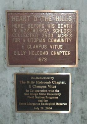
1. Heart o' the Hills Marker
Here, before his death in 1927, Murray Schloss collected 2500 acres for a utopian community.
E Clampus Vitus Billy Holcomb Chapter - 1973
Re-dedicated by the Billy Holcomb Chapter E Clampus Vitus in co-operation with the San Diego State University Field Station Programs and the Santa Margarita Ecological Reserve, July 29, 2006.
Erected 1973 by E Clampus Vitus, San Diego State University, and the Santa Margarita Ecological Reserve. (Marker Number 128.)
Topics and series. This historical marker is listed in these topic lists: Industry & Commerce • Settlements & Settlers. In addition, it is included in the Communal and Utopian Societies, and the E Clampus Vitus series lists. A significant historical month for this entry is July 1999.
Location. 33° 27.78′ N, 117° 10.253′ W. Marker is in Temecula, California, in Riverside County. It is at the intersection of Vía Tornado and Via Novillo, on the right when traveling north on Vía Tornado. The site is west of Temecula, near Murrieta Creek and the Santa Margarita River. Touch for map. Marker is in this post office area: Temecula CA 92590, United States of America.
this page online

Regionally, this marker is in Greater Los Angeles, in the Inland Empire, and in the Peninsular Ranges. It is also in the American Southwest. Globally, it is in North America, on the Ring of Fire, on the Pacific Rim, in the Western Hemisphere, in the Western World, and in the Anglosphere. Historically, it finds itself in what was once New Spain and also Mexico’s Alta California.
Other nearby markers. At least 8 other markers are within 5 miles of this marker, measured as the crow flies: First National Bank (approx. 2½ miles away); Hotel Rooms (approx. 4.3 miles away); Vail Ranch Cookhouse (approx. 4.3 miles away); Foreman's House (approx. 4.3 miles away); The Bunkhouse (approx. 4.3 miles away); Butterfield Stagecoaches (approx. 4.3 miles away); The Wolf Store (approx. 4.4 miles away); Cowboys (approx. 4.4 miles away). Touch for a list and map of all markers in Temecula.
More about this marker. This was the second and last aluminum plaque erected by the Billy Holcomb Chapter.
This plaque was originally placed approximately near the intersection of Camino Estribo and Via Gorrion in the foothills
Photographed by Chris Bell
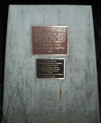
2. Heart o' the Hills Marker
In 1988, Gabe Lopes XNGH-1975 and James McMullen XNGH-1979 searched the hillside for the plaque to no avail. The plaque had been placed above the north side of the Santa Margarita River, but became misplaced during the clearing of the land for the citrus groves.
In 1988, Gabe Lopes XNGH-1975 and James McMullen XNGH-1979 searched the hillside for the plaque to no avail. The marker had been erected above the north side of the Santa Margarita River, but became misplaced during the clearing of the land for the citrus groves.
SOURCE: Billy Holcomb Chapter 1069 35th Anniversary Plaque Book by Phillip Holdaway
Regarding Heart o' the Hills. Murray Schloss, who had inherited money from his father, a clothing millionaire, had claimed to hear voices from the "Masters," who directed him to build the "Temple of the Dawn" in this "Heart of the Hills" region of Gavilan Mountain.
SOURCE: Billy Holcomb Chapter 1069 35th Anniversary Plaque Book by Phillip Holdaway
Credits. This page was last revised on September 4, 2025. It was originally submitted on December 17, 2011, by Michael Kindig of Elk Grove, California. This page has been viewed 1,446 times since then and 35 times this year. Last updated on November 3, 2014, by Michael Kindig of Elk Grove, California. Photos: 1, 2. submitted on December 17, 2011, by Michael Kindig of Elk Grove, California. • Bill Pfingsten was the editor who published this page.
Editor’s want-list for this marker. Wide view photo of the marker showing its location. • Can you help?
