Yucca Valley in San Bernardino County, California — The American West (Pacific Coastal)
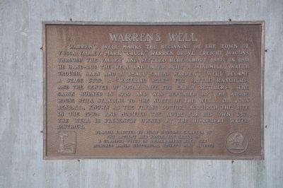
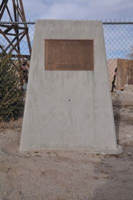
Warren's Well
Erected 2002 by Billy Holcomb Chapter No. 1069, E Clampus Vitus in cooperation with the Morongo Basin Historical Society. (Marker Number 109.)
Topics and series. This historical marker is listed in these topic lists: Industry & Commerce • Natural Resources • Settlements & Settlers. In addition, it is included in the E Clampus Vitus series list. A significant historical year for this entry is 1880.
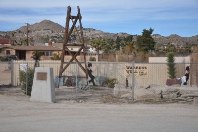
Location. 34° 7.845′ N, 116° 24.392′ W. Marker is in Yucca Valley, California, in San Bernardino County. Marker is on Crestview Drive east of Airway Avenue. Marker is located approximately 400 feet east of the intersection at the end of the cul-de-sac. Touch for map. Marker is at or near this postal address: 57585-57699 Crestview Drive, Yucca Valley CA 92284, United States of America. Touch for directions.
Other nearby markers. At least 3 other markers are within 12 miles of this marker, measured as the crow flies. Pioneertown (approx. 5.6 miles away); Morongo Indian Village (approx. 11.1 miles away); The Integratron (approx. 11.4 miles away).
Regarding Warren's Well. Chuck Warren settled here in the 1880's. Yucca Valley was named after the Joshua Tree (Yucca brevifolia) or "tree yucca" as Dr. Edmund Jaeger referred to them. Yucca Valley did not have a post office until 1945. Mail used to be delivered as far as Whitewater and then volunteers would take it up to Warren's Well for distribution. This is the original site of Warren's Well. Chuck Warren was wise to pay attention to the vegetation and thereby deduce he could dig a well that would provide water. SOURCE: Billy Holcomb Chapter 1069 35th Anniversary Plaque Book by Phillip Holdaway
Photographed By Michael Kindig, January 16, 2011
4. Warren's Well
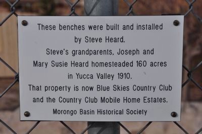
These benches were built and installed by Steve Heard. Steve's grandparents, Joseph and Mary Susie Heard homesteaded 160 acres in Yucca Valley 1910. That property is now Blue Skies Country Club and the Country Club Mobile Home Estates.
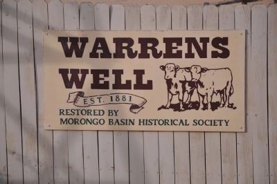
Morongo Basin Historical Society
Morongo Basin Historical Society
Photographed By Michael Kindig, January 16, 2011
6. Warren's Well
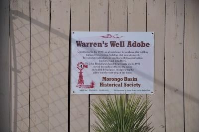
Warren's Well Adobe
Constructed in the 1930's as a bunkhouse for cowboys, this building replaced two previous buildings that were destroyed. Two separate individuals are credited with is construction: Jim Dever and John Berry. Dr. John Bendall purchased the property and in 1957 moved his medical office to the adobe and added living space, incorporating the adobe into the west wing of the house.
Morongo Basin Historical Society
MBHS Site 1 P36-009610 CA-SBR-9610 Sign Sponsored by Sunset Rotary Club of Joshua Tree
Credits. This page was last revised on October 15, 2020. It was originally submitted on December 20, 2011, by Michael Kindig of Elk Grove, California. This page has been viewed 2,665 times since then and 123 times this year. Last updated on November 3, 2014, by Michael Kindig of Elk Grove, California. Photos: 1. submitted on December 20, 2011, by Michael Kindig of Elk Grove, California. 2, 3, 4, 5, 6. submitted on December 25, 2011, by Michael Kindig of Elk Grove, California. • Bill Pfingsten was the editor who published this page.
