Waynesboro in Burke County, Georgia — The American South (South Atlantic)
Burke County
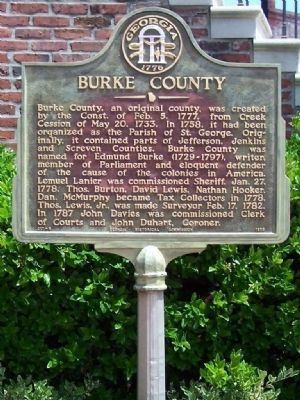
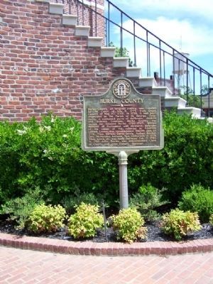
Burke County, an original county, was created by the Const. of Feb. 5, 1777, from Creek Cession of May 30, 1733. In 1758, it had been organized as the Parish of St. George. Originally, it contained parts of Jefferson, Jenkins and Screven Counties. Burke County was named for Edmund Burke (1729-1797), writer, member of Parliament and eloquent defender of the cause of the colonies in America. Lemuel Lanier was commissioned Sheriff, Jan. 27, 1778. Thos. Burton, David Lewis, Nathan Hooker, Dan. McMurphy became Tax Collectors in 1778. Thos. Lewis, Jr., was made Surveyor Feb. 17, 1782. In 1787 John Davies was commissioned Clerk of Courts and John Duhart, Coroner.
Erected 1956 by Georgia Historical Commission. (Marker Number 017-6.)
Topics and series. This historical marker is listed in these topic lists: Colonial Era • Political Subdivisions • Settlements & Settlers. In addition, it is included in the Georgia Historical Society series list. A significant historical date for this entry is May 30, 1804.
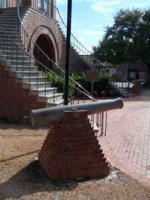
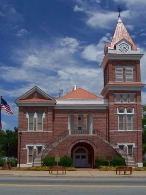
Location. 33° 5.422′ N, 82° 0.951′ W. Marker is in Waynesboro, Georgia, in Burke County. Marker is at the intersection of North Liberty Street (U.S. 25) and Court Street, on the right when traveling north on North Liberty Street. Located at the County Courthouse in Waynesboro. Touch for map. Marker is in this post office area: Waynesboro GA 30830, United States of America. Touch for directions.
Other nearby markers. At least 8 other markers are within walking distance of this marker. Burke County's 8 Governors (here, next to this marker); Burke County Veterans Memorial (a few steps from this marker); Washington’s Southern Tour (a few steps from this marker); Lost Burke County Men S.S. Otranto (a few steps from this marker); Waynesborough (a few steps from this marker); To Honor George Washington (about 400 feet away, measured in a direct line); The J.D. Roberts Home (about 400 feet away); Shell Bluff (about 400 feet away). Touch for a list and map of all markers in Waynesboro.
Regarding Burke County. Burke is an original county of Georgia, created February 5, 1777. During the American Civil War, the county provided the Poythress Volunteers and the Grubb's Hussars, which were a part of Cobb's Legion.
Also see . . .
1. The Early Days of Burke County. New Georgia Encyclopedia website entry:
The original inhabitants of the area were Creek, Cherokee, and Catawba Indians, who lost their land when members of their leadership, often not speaking for all of them, signed treaties in 1733, 1736, and 1758 with the English (Submitted on May 22, 2008, by Mike Stroud of Bluffton, South Carolina.)
2. Edmund Burke. Wikipedia entry:
He is mainly remembered for his support of the American colonies in the dispute with King George III and Great Britain that led to the American Revolution and for his strong opposition to the French Revolution. (Submitted on May 22, 2008, by Mike Stroud of Bluffton, South Carolina.)
Credits. This page was last revised on November 27, 2021. It was originally submitted on May 22, 2008, by Mike Stroud of Bluffton, South Carolina. This page has been viewed 2,280 times since then and 39 times this year. Photos: 1, 2. submitted on May 22, 2008, by Mike Stroud of Bluffton, South Carolina. 3. submitted on February 2, 2011, by Mike Stroud of Bluffton, South Carolina. 4. submitted on May 22, 2008, by Mike Stroud of Bluffton, South Carolina. • Craig Swain was the editor who published this page.


