Near Turpin in Beaver County, Oklahoma — The American South (West South Central)
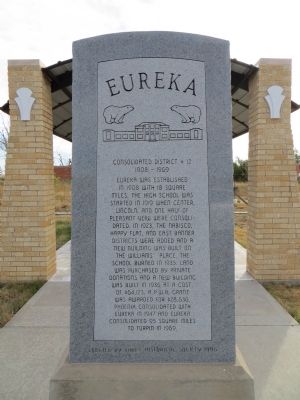
Eureka
Consolidated District #12
| — | 1908 - 1969 | — |
Photographed by Bill Kirchner, October 5, 2014
1. Eureka Marker
Erected 1996 by Baker Historical Society.
Topics. This historical marker is listed in these topic lists: Education • Settlements & Settlers. A significant historical year for this entry is 1908.
Location. 36° 51.895′ N, 101° 1.055′ W. Marker is near Turpin, Oklahoma, in Beaver County. It is on Mendenhall Street (County Route 12) 0.1 miles north of Panhandle Street (U.S. 64), on the right when traveling north. Touch for map. Marker is in this post office area: Turpin OK 73950, United States of America. Touch for directions.

Regionally, this marker is in Northwest Oklahoma
this page online
Other nearby markers. At least 8 other markers are within 14 miles of this marker, measured as the crow flies: A different marker also named Eureka (here, next to this marker); Shade's Well (approx. 6.7 miles away); Panhandle Baptists (approx. 7 miles away); Graham–Hoeme Chisel Plow (approx. 10.8 miles away); Liberal Army Air Base Memorial (approx. 13 miles away in Kansas); When Coronado came to Kansas (approx. 13.1 miles away in Kansas); Rock Island Lines (approx. 13.2 miles away in Kansas); Original Hand-Dug Well (approx. 13.2 miles away in Kansas).
Photographed by Bill Kirchner, October 5, 2014
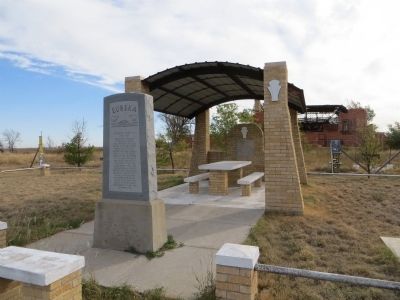
2. Eureka Marker
Photographed by Bill Kirchner, October 5, 2014
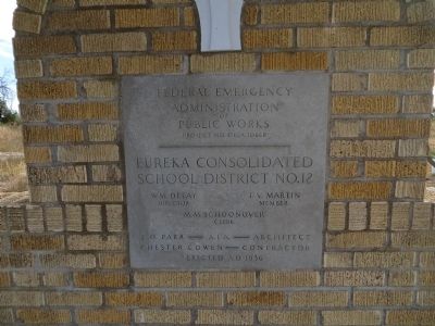
3. PWA marker at rear of ramada.
Photographed by Bill Kirchner, October 5, 2014
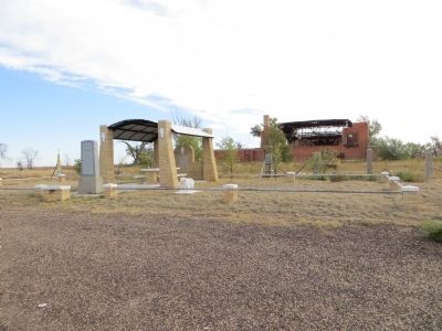
4. Eureka Marker
Credits. This page was last revised on October 1, 2025. It was originally submitted on November 11, 2014, by Bill Kirchner of Tucson, Arizona. This page has been viewed 1,049 times since then and 62 times this year. Photos: 1, 2, 3, 4. submitted on November 11, 2014, by Bill Kirchner of Tucson, Arizona. • Bernard Fisher was the editor who published this page.
