Downtown in St. Louis, Missouri — The American Midwest (Upper Plains)
La Grande Rue
First Street
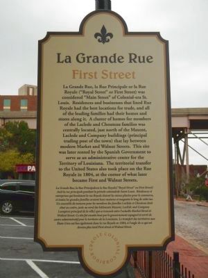
Photographed by Barry Swackhamer, August 16, 2014
1. La Grande Rue Marker
French
this page online
Erected 2014 by Creole Colonial Corridor.
Topics. This historical marker is listed in this topic list: Roads & Vehicles. A significant historical year for this entry is 1804.
Location. Marker has been reported missing. It was located near 38° 37.848′ N, 90° 10.997′ W. Marker was in St. Louis, Missouri. It was in Downtown. It was on North First Street near Morgan Street, on the left when traveling north. Touch for map. Marker was at or near this postal address: 801 North First Street, Saint Louis MO 63102, United States of America. Touch for directions.

Regionally, this marker was in the
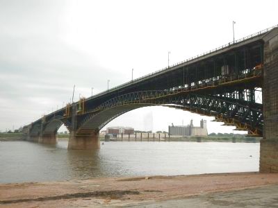
Photographed by Barry Swackhamer, August 16, 2014
2. The Eads Bridge
Other nearby markers. At least 8 other markers are within walking distance of this location: Rue de l’Eglise (about 300 feet away, measured in a direct line); About This Place / Black Wealth and Influence (about 400 feet away); In Memory of Katherine Ward Burg (about 400 feet away); The Eads Bridge (about 500 feet away); The James B. Eads Bridge (about 600 feet away); 1996 (approx. 0.2 miles away); 1994 (approx. 0.2 miles away); 1995 (approx. 0.2 miles away). Touch for a list and map of all markers in St. Louis.
Other markers no longer nearby. Old Missouri Hotel (was a few steps from this marker but has been confirmed missing); Rue Royale (was about 300 feet away but has been confirmed missing); Old Judge Coffee Bldg. (was about 400 feet away but has been confirmed missing);
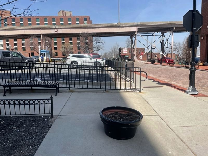
Photographed by Garrett Koch, March 20, 2026
3. La Grande Rue Marker is MISSING!
This is another one of the six sheet metal historic signs that were all installed back during the 250th anniversary of the founding of the village of Saint Louis. Others are missing as well but not all of them.
This photo shows the King Bridge in the background as well as the Laclede Landing parking lot and Lumiere Hotel. As with the "Rue Royale - First Street" marker that's also missing, the sidewalks were renovated sometime before April 2025 (as shown in Googlemaps photos). So hopefully they weren't stolen or destroyed but are just sitting in a storage standby shed somewhere.
More about this marker. This is one of seven markers that were placed in the city of St. Louis in October 2014, in honor of the city's 250th birthday. Marker is placed in Laclede's Landing neighborhood.
Credits. This page was last revised on March 31, 2026. It was originally submitted on November 12, 2014, by Barry Swackhamer of Brentwood, California. This page has been viewed 638 times since then and 38 times this year. Photos: 1, 2. submitted on November 12, 2014, by Barry Swackhamer of Brentwood, California. 3. submitted on March 21, 2026, by Garrett Koch of Saint Louis, Missouri. • Al Wolf was the editor who published this page.
