Near Ritter in Colleton County, South Carolina — The American South (South Atlantic)
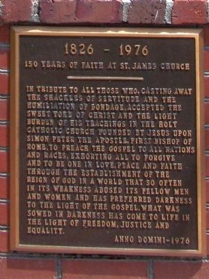
150 Years Of Faith at St. James Church
1826-1976
Photographed by Mike Stroud, May 2008
1. 1826-1976 Marker
Anno Domini (Medieval Latin: In the year of (the/Our) Lord), abbreviated as AD or A.D.
Anno Domini- 1976.
Erected 1976 by Saint James Church.
Topics. This historical marker is listed in these topic lists: African Americans • Religion & Religious Structures. A significant historical year for this entry is 1976.
Location. 32° 46.592′ N, 80° 39.739′ W. Marker is near Ritter, South Carolina, in Colleton County. It is on Ritter Road (State Highway S-15-41) near Catholic Church Creek Road, on the left when traveling east. 2.5 miles West of intersection with SC Hwy 303,
this page online

Regionally, this marker is in the Lowcountry, in the Ashepoo and Combahee and Edisto Basin. It is also in the American South, specifically in the Deep South, and on the Eastern Seaboard. Globally, it is in the North Atlantic Region, North America, the Western Hemisphere, the Western World, and the Anglosphere. Historically, it finds itself in what was once New Spain, the territory of the Mississippian Culture, one of the original Thirteen Colonies, one of the Confederate States of America, and the Antebellum South.
Other nearby markers. At least 8 other markers are within 9 miles of this marker, measured as the crow flies: Catholic Hill (here, next to this marker); Hendersonville / Arab The Horse (approx. 3.8 miles away); Temple of Sport (approx. 5½ miles away); Edmundsbury (approx. 6½ miles away); Walterborough Academy (approx. 8.7 miles away); Colleton Rural Fire Department Charter Members (approx. 8.7 miles away); Colleton County Courthouse (approx.
Photographed by Mike Stroud, 2008
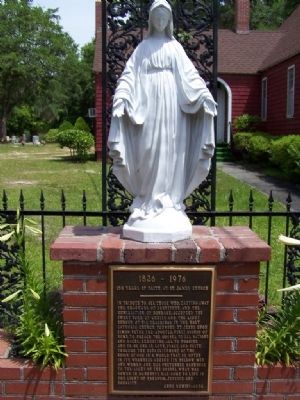
2. 150 Years Of Faith at St. James Church Marker
Photographed by Mike Stroud, 2008
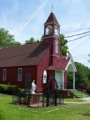
3. St. James Church with Marker
Photographed by Mike Stroud, May 2008
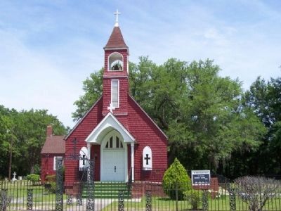
4. St. James Church , Ritter Community
Credits. This page was last revised on June 16, 2016. It was originally submitted on May 24, 2008, by Mike Stroud of Bluffton, South Carolina. This page has been viewed 1,585 times since then and 30 times this year. Photos: 1, 2, 3, 4. submitted on May 24, 2008, by Mike Stroud of Bluffton, South Carolina. • Christopher Busta-Peck was the editor who published this page.
