Fort Calhoun in Washington County, Nebraska — The American Midwest (Upper Plains)
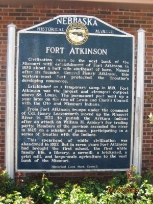
Fort Atkinson
Established as a temporary camp in 1819, Fort Atkinson was the largest and strongest outpost above St. Louis. The permanent post went up a year later on the site of Lewis and Clark's Council with the Oto and Missouri Indians.
From Fort Atkinson troops under the command of Col. Henry Leavenworth moved up the Missouri River in 1823 to punish the Arikara Indians after an attack on William H. Ashley's fur trading party. Members of the garrison ascended the river in 1825 on a mission of peace, participating in a series of treaties with the Indians.
This spearhead of white civilization was abandoned in 1827. But in seven years Fort Atkinson had brought the first school, the first white family life, a library, a sawmill, a brickyard, a grist mill, and large-scale agriculture to the west bank of the Missouri.
Erected by Historical Land Mark Council. (Marker Number 2.)
Topics and series. This historical marker is listed in these topic lists: Exploration • Forts and Castles • Military • Settlements & Settlers. In addition, it is included in the Nebraska State Historical Society series list. A significant historical year for this entry is 1820.
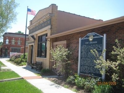
Location. 41° 27.364′ N, 96° 1.581′ W. Marker is in Fort Calhoun, Nebraska, in Washington County. Marker is at the intersection of U.S. 75 and Monroe Street, on the left when traveling north on U.S. 75. Marker is located in front of the Washington County Historical Museum. Touch for map. Marker is in this post office area: Fort Calhoun NE 68023, United States of America. Touch for directions.
Other nearby markers. At least 8 other markers are within 5 miles of this marker, measured as the crow flies. The Death of Marshal Suverkrubbe (approx. 0.3 miles away); Lewis and Clark Campsite (approx. 0.6 miles away); a different marker also named Fort Atkinson (approx. 0.7 miles away); The Lewis and Clark Expedition (approx. 4 miles away); Up the Missouri (approx. 4 miles away); Steamboat Bertrand (approx. 4˝ miles away); DeSoto Townsite (approx. 4.8 miles away); Lewis and Clark Campsite Area (approx. 4.9 miles away). Touch for a list and map of all markers in Fort Calhoun.
Credits. This page was last revised on November 30, 2020. It was originally submitted on May 24, 2008, by Michael James of Fort Calhoun, Nebraska. This page has been viewed 1,510 times since then and 20 times this year. Photos: 1, 2. submitted on May 24, 2008, by Michael James of Fort Calhoun, Nebraska. • Kevin W. was the editor who published this page.

