Placentia in Avalon Peninsula, Newfoundland, Newfoundland and Labrador — The Atlantic Provinces (North America)
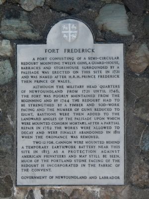
Fort Frederick
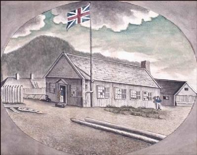
Although the military head quarters of Newfoundland from 1721 until 1746, the fort was poorly maintained from the beginning and by 1744 the redoubt had to be strength(en)ed by a timber and sod-work facing and the number of guns reduced to eight, bastions were then added to the landward angles of the palisade upon which were mounted Cohorn mortars. After a partial repair in 1762 the works were allowed to decay and were finally abandoned in 1811 when the ordnance was remove.
Two 12 pdr. cannon were mounted behind a temporary earthwork battery near this site in 1813 as a protection against American privateers and may still be seen. Much of the portland stone facing of the redoubt is incorporated in the fabric of the convent.
Erected by Government of Newfoundland and Labrador.
Topics. This historical marker is listed in this topic list: Forts and Castles. A significant historical year for this entry is 1721.
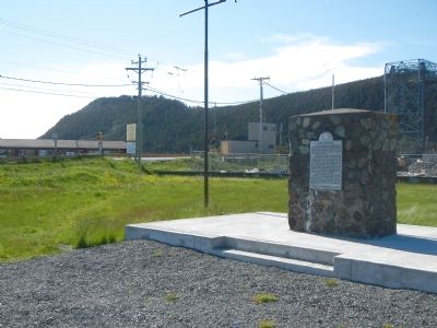
Location. 47° 14.947′ N, 53° 57.703′ W. Marker is in Placentia, Newfoundland and Labrador, in Avalon Peninsula, Newfoundland. Marker is on Main Street (Route 100 South) close to Orcan Drive, on the left when traveling south. Touch for map. Marker is in this post office area: Placentia NL A0B, Canada. Touch for directions.
Other nearby markers. At least 5 other markers are within walking distance of this marker. (Fort Royal) (approx. 0.8 kilometers away); Port Royal and Castle Graves (approx. 0.8 kilometers away); Fort Royal (Plaisance) (approx. 0.8 kilometers away); Castle Hill (approx. 0.8 kilometers away); a different marker also named Castle Hill (approx. 0.8 kilometers away).
Also see . . . Placentia, Newfoundland and Labrador - Wikipedia. Placentia is a town on the Avalon Peninsula, Newfoundland and Labrador, consisting of the amalgamated communities of Jerseyside, Townside, Freshwater, Dunville and Argentia. Common family names include Caul, Nolan, Power, O'Keefe, Wyse, Collins, O'Reilly, Murphy, Williams, Gambin, Hatfield, Wadman, Barry, Mooney, and Careen. (Submitted on November 15, 2014, by Barry Swackhamer of Brentwood, California.)
Credits. This page was last revised on June 16, 2016. It was originally submitted on November 15, 2014, by Barry Swackhamer of Brentwood, California. This page has been viewed 356 times since then and 27 times this year. Photos: 1, 2, 3. submitted on November 15, 2014, by Barry Swackhamer of Brentwood, California. • Andrew Ruppenstein was the editor who published this page.


