Damascus in Mahoning County, Ohio — The American Midwest (Great Lakes)
Friends Burying Grounds
(1807-1843)
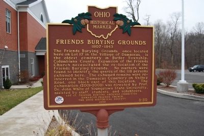
Photographed by Mike Wintermantel, November 16, 2014
1. Friends Burying Grounds Marker
The Friends Burying Grounds, once located here on Lot 17 in the Village of Damascus, is the oldest cemetery in Butler Township, Columbiana County. Expansion of the Friends Church necessitated the re-location of the Friends Burying Grounds. No markers were found to identify the graves of the 118 persons exhumed here. The exhumed remains were re-interred in the Damascus Cemetery on Valley Road, one block east of this location. The exhumation (2001-2002) was directed by Prof. Dr. John White of Youngstown State University, assisted by staff, students, and volunteers.
Erected 2002 by Lot 17, Friends Burying Grounds Committee, Damascus Friends Church, and The Ohio Historical Society. (Marker Number 7-50.)
Topics and series. This historical marker is listed in these topic lists: Cemeteries & Burial Sites • Religion & Religious Structures. In addition, it is included in the Ohio Historical Society / The Ohio History Connection series list.
Location. 40° 54.04′ N, 80° 57.337′ W. Marker is in Damascus, Ohio, in Mahoning County. It can be reached from the intersection of
this page online

Regionally, this marker is in Ohio’s Western Reserve and in the Mahoning Valley. It is also in the American Midwest. Globally, it is in North America, the Western Hemisphere, the Western World, and the Anglosphere. Historically, it finds itself in what was once the Haudenosaunee (Iroquois) Confederacy, the territory of the Mississippian Culture, and the Northwest Territory.
Other nearby markers. At least 8 other markers are within 6 miles of this marker, measured as the crow flies: Ervin George Bailey (about 700 feet away, measured in a direct line); Damascus Grade School Museum (about 700 feet away); Lot 17, Friends Burying Grounds (approx. 0.2 miles away); Tract of the City of Alliance (approx. 0.2 miles away); Maple-Dell (approx. 1.7 miles away); Stage Coach Inn (approx. 4.3 miles away); Salem (approx. 5.9 miles away); Unserheim (approx. 6 miles away). Touch for a list and map of all markers in Damascus.
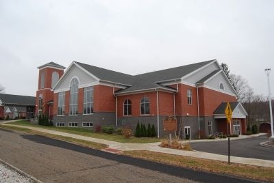
Photographed by Mike Wintermantel, November 16, 2014
2. Damascus Friends Church and Burying Grounds Marker
Church website homepage
Click for more information.
Click for more information.
Credits. This page was last revised on May 21, 2022. It was originally submitted on November 16, 2014, by Mike Wintermantel of Pittsburgh, Pennsylvania. This page has been viewed 1,109 times since then and 72 times this year. Photos: 1, 2. submitted on November 16, 2014, by Mike Wintermantel of Pittsburgh, Pennsylvania.
