St. John's in Avalon Peninsula, Newfoundland, Newfoundland and Labrador — The Atlantic Provinces (North America)
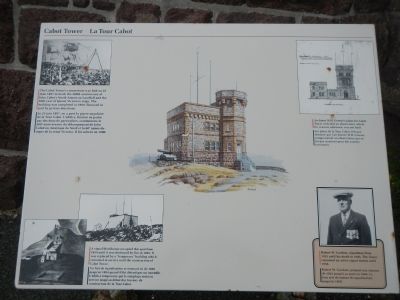
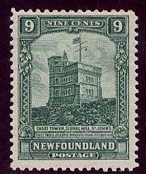
Cabot Tower
La Tour Cabot
The Cabot Tower’s cornerstone was laid on 23 June 1897 to mark the 400th anniversary of John Cabot’s North American Landfall and the 60th year of Queen Victoria’s reign. The building was completed in 1900, financed in part by private donations. / Le 23 juin 1897, on a posé la pierre angulaire de la Tour Cabot. L’édifice, financé en partie par des dons de particuliers, commémore le 400ᵉ anniversaire du débarquement de John Cabot en Amérique du Nord et la 60ᵉ année du règne de la reine Victoria. Il fut achevé en 1900.
Architect W.H. Greene’s plans for Cabot Tower included an observatory which, for reasons unknown, was not built. / Les plans de la Tour Cabot, tels que dessinés par l’architecte W.H. Greene, comprenaient un observatoire qui ne fut pas construit pour des raisons inconnues.
Robert W. Gardner, signalman from 1923 until his death in 1946. The Tower remained an active signal station until 1958. / Robert W. Gardner, préposé aux signaux de 1923 jusqu’à sa mort en 1946. La tour sert de station de signalisation jusqu’en 1958.
A signal blockhouse occupied this spot from 1859 until it was destroyed by fire in 1894. It was replace by a “temporary” building which remained in service until the construction of Cabot Tower. / Un fort de signalisation se trouvait ici de 1859 jusqu’en 1894 quand il fut détruit par un incendie. L’édifice temporaire que le remplaça en service jusqu’au début des travaux de construction de la Tour Cabot.
Topics. This historical marker is listed in this topic list: Communications. A significant historical date for this entry is June 23, 1897.
Location. 47° 34.203′ N, 52° 40.917′ W. Marker is in St. John's, Newfoundland and Labrador, in Avalon Peninsula, Newfoundland. Marker can be reached from Signal Hill Road. Touch for map. Marker is in this post office area: St John's NL A1A, Canada. Touch for directions.
Other nearby markers. At least 8 other markers are within walking distance of this marker. Battle of Signal Hill (here, next to this marker); Peacetime Use (a few steps from this marker); Noon Day Gun (a few steps from this marker); Fishery (a few steps from this marker); Swiling (a few steps from this marker); Ice (within shouting distance of this marker); 1892: The Great Fire (within shouting distance of this marker); Transatlantic Radio Signals (within shouting distance of this marker). Touch for a list and map of all markers in St. John's.
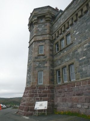
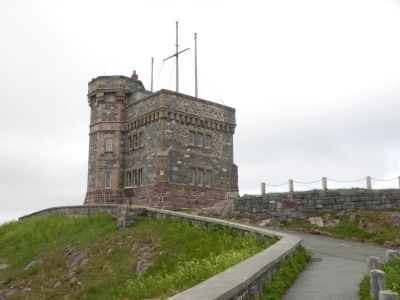
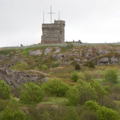
More about this marker. This marker is next to Cabot Tower in Signal Hill National Historic Site.
Also see . . . Cabot Tower - Wikipedia. The building was used primarily for flag signalling. The British military first used Signal Hill, originally known as the Lookout, for this purpose in around 1704. There was a mast at the highest point on the hill, and it would be the job of a signalman to keep an eye out for ships approaching the city. (Submitted on November 17, 2014, by Barry Swackhamer of Brentwood, California.)
Credits. This page was last revised on June 16, 2016. It was originally submitted on November 17, 2014, by Barry Swackhamer of Brentwood, California. This page has been viewed 626 times since then and 31 times this year. Photos: 1, 2, 3, 4, 5. submitted on November 17, 2014, by Barry Swackhamer of Brentwood, California. • Andrew Ruppenstein was the editor who published this page.
