Castroville in Medina County, Texas — The American South (West South Central)
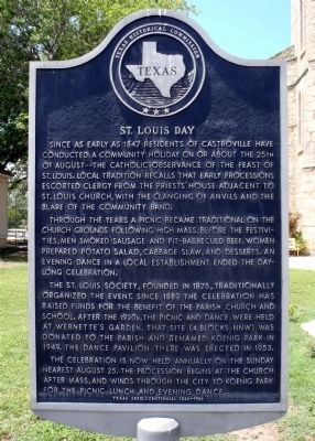
St. Louis Day
Through the years a picnic became traditional on the church grounds following High Mass. Before the festivities, men smoked sausage and pit-barbecued beef. Women prepared potato salad, cabbage slaw, and desserts. An evening dance in a local establishment ended the day-long celebration.
The St. Louis Society, founded in 1875, traditionally organized the event. Since 1889 the celebration has raised funds for the benefit of the Parish church and school. After the 1920s, the picnic and dance were held at Wernette's Garden. That site (4 blocks NNW) was donated to the parish and renamed Koenig Park in 1949. The dance pavilion there was erected in 1953.
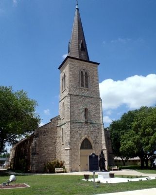
The celebration is now held annually on the Sunday nearest August 25. The procession begins at the church after Mass, and winds through the city to Koenig Park for the picnic lunch and evening dance.
Erected 1986 by Texas Historical Commission. (Marker Number 5054.)
Topics. This historical marker is listed in these topic lists: Churches & Religion • Settlements & Settlers. A significant historical year for this entry is 1847.
Location. 29° 21.355′ N, 98° 52.757′ W. Marker is in Castroville, Texas, in Medina County. Marker is at the intersection of Angelo Street and Paris Street, on the left when traveling north on Angelo Street. Touch for map. Marker is at or near this postal address: 610 Madrid Street, Castroville TX 78009, United States of America. Touch for directions.
Other nearby markers. At least 8 other markers are within walking distance of this marker. St. Louis Catholic Church (a few steps from this marker); Alsatians of Texas (within shouting distance of this marker); General Wool and the Chihuahua Road (within shouting distance of this marker); Louis Ferdinand Huth, Jr. (within shouting distance of this marker); St. Louis Church (about 300 feet away, measured in a direct line); Dubuis House (about 400 feet away); Moye (about 600 feet away); Dolch-Hans Compound (approx. 0.2 miles away). Touch for a list and map of all markers in Castroville.
Credits. This page was last revised on June 16, 2016. It was originally submitted on November 22, 2014, by William F Haenn of Fort Clark (Brackettville), Texas. This page has been viewed 558 times since then and 30 times this year. Photos: 1, 2, 3. submitted on November 22, 2014, by William F Haenn of Fort Clark (Brackettville), Texas. • Bernard Fisher was the editor who published this page.


