
St. John's in CensusDiv 1 - Avalon Peninsula-St. John's, Newfoundland and Labrador — The Atlantic Provinces (North America)
O’Dwyer Block
1847
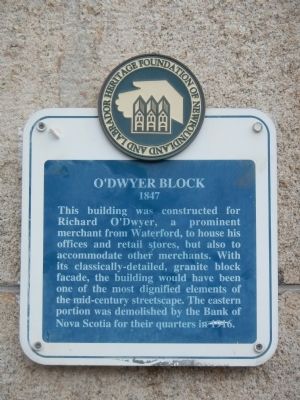
Photographed by Barry Swackhamer, June 22, 2014
1. O’Dwyer Block Marker
Erected by Heritage Foundation of Newfoundland and Labrador.
Topics. This historical marker is listed in this topic list: Industry & Commerce. A significant historical year for this entry is 1916.
Location. 47° 33.707′ N, 52° 42.594′ W. Marker is in St. John's, Newfoundland and Labrador, in CensusDiv 1 - Avalon Peninsula-St. John's. It is on Water Street close to Beck's Cove, on the right when traveling north. Touch for map. Marker is at or near this postal address: 301 Water Street, St John's NL A1C, Canada. Touch for directions.

Regionally, this marker is in Atlantic Canada. Globally, it is in the North Atlantic Region, North America, the Western Hemisphere, the Western World, and the Anglosphere. Historically,
this page online
Other nearby markers. At least 8 other markers are within walking distance of this marker: Thompson Building (a few steps from this marker); St. John’s Court House (approx. 0.3 kilometers away); (Royal Newfoundland Constabulary Monument) (approx. 0.3 kilometers away); John Reeves (approx. 0.4 kilometers away); Gower Street United Church (approx. 0.4 kilometers away); St. John the Baptist Anglican Cathedral (approx. 0.4 kilometers away); William Carson (approx. 0.4 kilometers away); Masonic Temple (approx. half a kilometer away). Touch for a list and map of all markers in St. John's.
Also see . . . O'Dwyer Block - Heritage Foundation of Newfoundland & Labrador. Built in the mid-nineteenth century, the stone and mortar O'Dwyer Block was one of St. John's earliest major merchant buildings in not made of wood. (Submitted on November 22, 2014, by Barry Swackhamer of Brentwood, California.)
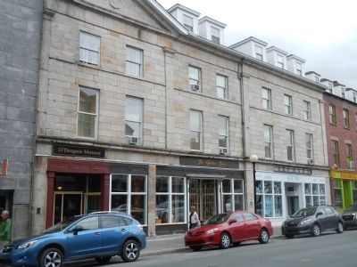
Photographed by Barry Swackhamer, June 22, 2014
2. O’Dwyer Block Marker
The marker is above the red car.
Credits. This page was last revised on December 21, 2025. It was originally submitted on November 22, 2014, by Barry Swackhamer of Brentwood, California. This page has been viewed 528 times since then and 21 times this year. Photos: 1, 2. submitted on November 22, 2014, by Barry Swackhamer of Brentwood, California. • Andrew Ruppenstein was the editor who published this page.
