Downtown West in Minneapolis in Hennepin County, Minnesota — The American Midwest (Upper Plains)
Former Site of Plymouth Congregational Church
1875 to 1907
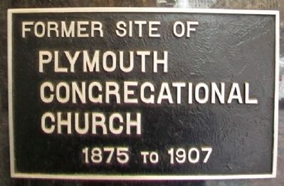
Photographed by William Fischer, Jr., October 5, 2014
1. Former Site of Plymouth Congregational Church Marker
Topics. This historical marker is listed in this topic list: Religion & Religious Structures.
Location. 44° 58.532′ N, 93° 16.395′ W. Marker is in Minneapolis, Minnesota, in Hennepin County. It is in Downtown West. It is on Nicollet Mall north of 9th Street, on the right when traveling north. Touch for map. Marker is at or near this postal address: 801 Nicollet Mall, Minneapolis MN 55402, United States of America. Touch for directions.

Regionally, this marker is in the Twin Cities Metropolitan Area. It is also in the American Midwest, in the Corn Belt, and in the Great River Road Region. Globally, it is in North America, the Western Hemisphere, the Western World, and the Anglosphere. Historically, it finds itself in what was once Rupert’s Land, the territory of the Mississippian Culture, and the Louisiana Purchase.
Other nearby markers. At least 8 other markers are within walking distance of this marker: Foshay Tower (about 400 feet away, measured in a direct line); Westminster Presbyterian Church (about 500 feet away); Minneapolis YMCA Central Building
this page online
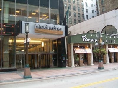
Photographed by William Fischer, Jr., October 5, 2014
2. Former Site of Plymouth Congregational Church Marker
Credits. This page was last revised on April 24, 2024. It was originally submitted on November 28, 2014, by William Fischer, Jr. of Reynoldsburg, Ohio. This page has been viewed 468 times since then and 11 times this year. Photos: 1, 2. submitted on November 28, 2014, by William Fischer, Jr. of Reynoldsburg, Ohio.
