Greensboro in Caroline County, Maryland — The American Northeast (Mid-Atlantic)
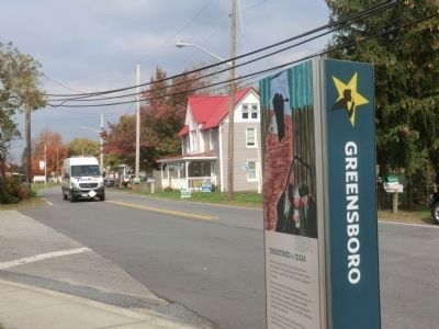
Greensboro
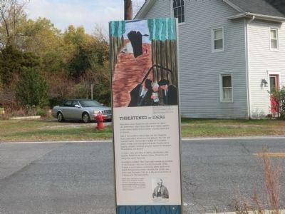
Threatened by Ideas
— Harriet Tubman Underground Railroad Byway —
More than cargo flowed through commercial towns like Greensboro. Abolitionist ideas and freedom seekers on the move created tension within a society dependent on slavery.
Site of the northern-most bridge over the Choptank River, Greensboro served as a link between the river and overland traffic. Dockworkers loaded and unloaded grains, timber, and manufacturing goods. Transferred to wagons, cargoes lumbered along to markets in Delaware, Philadelphia, and beyond. In return, news and ideas of liberty, abolitionism, and equality flowed to the Eastern Shore, influencing and energizing social discourse.
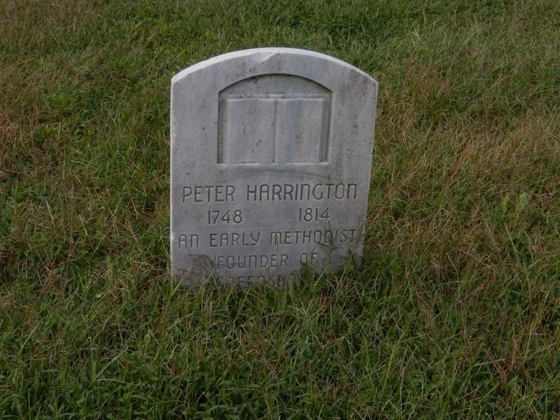
Greensboro resident Peter Harrington served as president of the Choptank Abolition Society during the 1790s. Formed in a pro-slavery community where abolitionist beliefs threatened economic interests, the society was short lived. Its legacy lived on in the secret activities of Underground Railroad agents.
[Caption:]
Right: Born into slavery in nearby Talbot County, Frederick Douglass learned to read despite the fact that the law forbade teaching an enslaved person to read or write. “Knowledge,” Douglas wrote, “is the pathway from slavery to freedom.”
Erected by America's Byways; Maryland Heritage Area Authority. (Marker Number 33.)
Topics and series. This historical marker is listed in these topic lists: Abolition & Underground RR • African Americans. In addition, it is included in the Harriet Tubman Underground Railroad Byway series list.
Location. Marker has been reported missing. It was located near 38° 58.56′ N, 75° 48.264′ W. Marker was in Greensboro, Maryland, in Caroline County. Marker was on North Main Street (Route 480) just south of Cedar Lane, on the right when traveling south. Touch for map. Marker was at or near this postal address: 209 North Main Street, Greensboro MD 21639, United States of America. Touch for directions.
Other nearby markers. At least 8 other markers are within 5 miles of this location, measured as the crow flies. Peter Harrington (here, next to this marker); Letter to Lincoln (about 400 feet away, measured in a direct line); Goldsborough House (approx. 0.2 miles away); Choptank River Park (approx. 0.3 miles away); a different marker also named Greensboro (approx. 0.3 miles away); Saulsbury House - Fifer Hospital - Ridgely House (approx. 4.7 miles away); Town of Ridgely Flag (approx. 4.7 miles away); The Drinking Fountain (approx. 4.7 miles away). Touch for a list and map of all markers in Greensboro.
Credits. This page was last revised on September 5, 2022. It was originally submitted on December 3, 2014, by Don Morfe of Baltimore, Maryland. This page has been viewed 616 times since then and 28 times this year. Photos: 1, 2. submitted on December 3, 2014, by Don Morfe of Baltimore, Maryland. 3. submitted on October 6, 2016, by Bill Pfingsten of Bel Air, Maryland. • Bill Pfingsten was the editor who published this page.


