Swedesboro in Gloucester County, New Jersey — The American Northeast (Mid-Atlantic)
Skirmish at Swedesboro
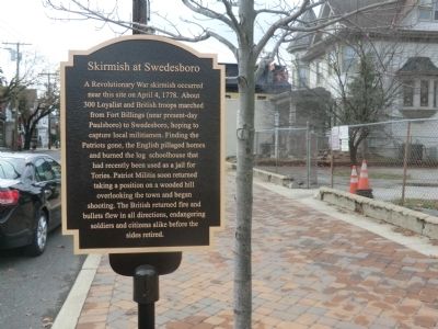
Photographed by Don Morfe, November 27, 2014
1. Skirmish at Swedesboro Marker
Topics. This historical marker is listed in this topic list: War, US Revolutionary. A significant historical month for this entry is April 1700.
Location. 39° 44.964′ N, 75° 18.486′ W. Marker is in Swedesboro, New Jersey, in Gloucester County. It is on Kings Highway. Touch for map. Marker is in this post office area: Swedesboro NJ 08085, United States of America. Touch for directions.

Regionally, this marker is in South Jersey and in Greater Philadelphia. It is also in the American Northeast, in the Mid-Atlantic, and on the Eastern Seaboard. Globally,
this page online
Other nearby markers. At least 8 other markers are within 5 miles of this marker, measured as the crow flies: Trinity Church (about 400 feet away, measured in a direct line); Trinity "Old Swedes" Church (about 400 feet away); a different marker also named Trinity Church (about 500 feet away); First Swedish Church (about 500 feet away); Stratton Hall (approx. 0.3 miles away); William Mullica House (approx. 4½ miles away); Bodo Otto (approx. 4½ miles away); The Mullica House (approx. 4½ miles away). Touch for a list and map of all markers in Swedesboro.
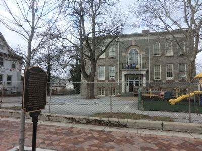
Photographed by Don Morfe, November 27, 2014
2. Skirmish at Swedesboro Marker
Credits. This page was last revised on June 16, 2016. It was originally submitted on December 6, 2014, by Don Morfe of Baltimore, Maryland. This page has been viewed 1,221 times since then and 243 times this year. Photos: 1, 2. submitted on December 6, 2014, by Don Morfe of Baltimore, Maryland. • Bill Pfingsten was the editor who published this page.
