Longboat Key in Sarasota County, Florida — The American South (South Atlantic)
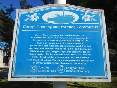
Corey's Landing and Farming Community
Byron Corey was one of the first homesteaders to be awarded land by the U.S. Government on Longboat Key. He was given 154 acres of land on Sarasota Bay in 1895. Until 1921, he had some of the finest tomatoes, guavas, limes and other produce for miles around. The first post office was built on Corey’s dock in 1907, and the steamer Mistletoe and others stopped to pick up vegetables for the Tampa market. The October 12th hurricane of 1921 covered most of Longboat Key with salt water which ended the truck farming business. The present condominium community of Corey’s Landing bears his name at this location.
Erected by Town of Longboat Key and Longboat Key Historical Society.
Topics. This historical marker is listed in these topic lists: Agriculture • Disasters • Settlements & Settlers. A significant historical year for this entry is 1895.
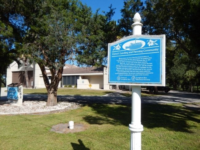
Location. 27° 21.605′ N, 82° 37.087′ W. Marker is in Longboat Key, Florida, in Sarasota County. Marker is on Gulf of Mexico Drive (State Road 789) half a mile north of Harbourside Drive, on the right when traveling north. The marker is located in front of the Longboat Key Fire Rescue Station No. 2. Touch for map. Marker is at or near this postal address: 2162 Gulf of Mexico Drive, Longboat Key FL 34228, United States of America. Touch for directions.
Other nearby markers. At least 8 other markers are within 4 miles of this marker, measured as the crow flies. World War II Bombing Range (approx. 2.7 miles away); Clyde Beatty (approx. 3.8 miles away); The Hanneford Family (approx. 3.8 miles away); Albert Rix (approx. 3.8 miles away); The Five Ringling Brothers (approx. 3.8 miles away); The Flying Palacios (approx. 3.8 miles away); P.T. Barnum (approx. 3.8 miles away); Merle Evans (approx. 3.8 miles away).
Also see . . .
1. Longboat Key.
Communities developed in the early 1900s at the north end of the island and mid-Key, where an agricultural community of approximately 18 families flourished. The Mistletoe steamship transported visitors between the island and the mainland and also shipped produce from farmer Byron Corey’s dock, known as Corey’s Landing. A hurricane in October 1921 destroyed island farming activity and most existing homes. But a storm could not wipe out island life. Throughout the next 30 years, families continued to move to Longboat Key, and on Nov. 13, 1955, residents voted to incorporate as a town. (Submitted on December 7, 2014, by Cosmos Mariner of Cape Canaveral, Florida.)
2. Longboat Key - 20 Things You May Not Know.
In the early 1990's, local contractor Bill Bowyer built Corey's Landing. Middens or piles of shells were uncovered at the site, evidence of Calusian Indians inhabating the area a thousand years ago. Bowyer aptly names the development Corey's Landing since
it was where Byron Corey owned a dock and post office. Corey built a dock to accommodate the Mistletoe, a ship out of Tampa, which made weekly mail runs. (Submitted on December 7, 2014, by Cosmos Mariner of Cape Canaveral, Florida.)
Credits. This page was last revised on June 16, 2016. It was originally submitted on December 7, 2014, by Cosmos Mariner of Cape Canaveral, Florida. This page has been viewed 403 times since then and 19 times this year. Photos: 1, 2. submitted on December 7, 2014, by Cosmos Mariner of Cape Canaveral, Florida. • Bernard Fisher was the editor who published this page.

