Near Chappell in Deuel County, Nebraska — The American Midwest (Upper Plains)
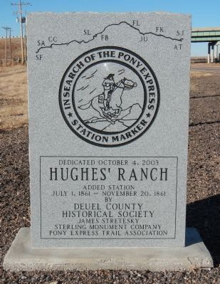
Hughes’ Ranch Pony Express Station
In Search of the Pony Express Stations
Hughes’ Ranch
Added Station
July 1, 1861 - Nov. 20. 1861
by
Deuel County
Historical Society
James Stretesky
Sterling Monument Company
Pony Express Trail Association
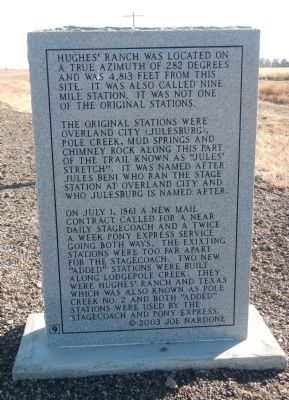
Hughes’ Ranch was located on a true azimuth of 282 degrees and was 4,813 feet from this site. It was also called Nine Mile Station. It was not one of the original stations.
The original stations were Overland City (Julesburg), Pole Creek, Mud Springs and Chimney Rock along this part of the trail known as “Jules Stretch”. It was named after Jules Beni who ran the stage station at Overland City and who Julesburg is named after.
On July 1, 1861 a new mail contract called for a near daily stagecoach and a twice a week Pony Express service going both ways. the exixting (sic) stations were too far apart for the stagecoach. Two new “added” stations were built along Lodgepole Creek. They were Hughes’ Ranch and Texas which was also known as Pole Creek No. 2 and both “added” stations were used by the stagecoach and Pony Express.
Erected 2003 by Deuel County Historical Society, James Stretesky, Sterling Monument Company, Pony Express Trail Association. (Marker Number 9.)
Topics and series. This historical marker is listed in these topic lists: Communications • Roads & Vehicles. In addition, it is included in the Pony Express National Historic Trail series list. A significant historical month for this entry is July 1846.
Location. 41° 3.301′ N, 102° 24.985′ W. Marker is near Chappell, Nebraska, in Deuel County. Marker is on Gold Rush Byway (U.S. 385), on the left when traveling north. Touch for map. Marker is in this post office area: Chappell NE 69129, United States of America. Touch for directions.
Other nearby markers. At least 8 other markers are within 7 miles of this marker, measured as the crow flies. Historic Lodgepole Creek Valley (approx. 3˝ miles away); B-24J Bomber Crash (approx. 3˝ miles away); "Dinky" Locomotive (approx. 6˝ miles away in Colorado); Ovid, Colorado (approx. 6.7 miles away in Colorado); See and Do,Off the Byway (approx. 6.7 miles away in Colorado); Prisoners on the Plains / Ride 'Em Cowboy (approx. 6.7 miles away in Colorado); Fort Sedgwick (approx. 6.7 miles away in Colorado); Early Campsites and River Crossings (approx. 6.7 miles away in Colorado). Touch for a list and map of all markers in Chappell.
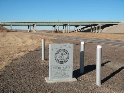
More about this marker. This marker is on U.S. Highway 385, just south of the U.S. Interstate 80 overpass.
Credits. This page was last revised on December 1, 2016. It was originally submitted on December 7, 2014, by Barry Swackhamer of Brentwood, California. This page has been viewed 635 times since then and 22 times this year. Photos: 1, 2, 3. submitted on December 7, 2014, by Barry Swackhamer of Brentwood, California. 4. submitted on November 30, 2016, by Rev. Ronald Irick of West Liberty, Ohio. • Bill Pfingsten was the editor who published this page.


