
Near L'Anse-au-Loup in CensusDiv 10 - Labrador-Happy Valley-Goose Bay, Newfoundland and Labrador — The Atlantic Provinces (North America)
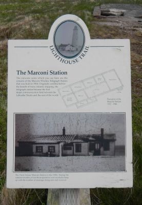
The Marconi Station
Lighthouse Trail
Photographed by Barry Swackhamer, June 27, 2014
1. The Marconi Station Marker
Captions: Floorplan of the Marconi Station 1922-1946.; The Point Amour Marconi Station in the 1930s. During the summer months at least three operators were need to keep up with the number of messages being sent and received.
Topics and series. This historical marker is listed in this topic list: Communications. In addition, it is included in the Lighthouses series list. A significant historical year for this entry is 1904.
Location. 51° 27.666′ N, 56° 51.454′ W. Marker is near L'Anse-au-Loup, Newfoundland and Labrador, in CensusDiv 10 - Labrador-Happy Valley-Goose Bay. It is on L'Anse Amour Branch Road close to Trans-Labrador Highway (Newfoundland and Labrador Route 510). Touch for map. Marker is in this post office area: L'Anse-au-Loup NL A0K 3L0, Canada. Touch for directions.

Regionally, this marker is in Atlantic Canada. Globally, it is in the North Atlantic Region, North America, the Western Hemisphere, the Western World, and the Anglosphere. Historically, it finds itself in what was once a British colony and also the Viceroyalty
this page online
Other nearby markers. At least 4 other markers are within 21 kilometers of this marker, measured as the crow flies: The Diaphone (within shouting distance of this marker); L’Anse Amour Burial (approx. 2.2 kilometers away); L'anse Amour (approx. 2.2 kilometers away); Thrombolites or Living Rocks (approx. 20.4 kilometers away).
Additional keywords. lighthouse
Photographed by Barry Swackhamer, June 27, 2014
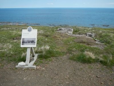
2. The Marconi Station Marker
Photographed by Barry Swackhamer, June 27, 2014
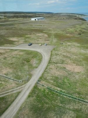
3. View from the lighthouse
The marker is located at the parking lot.
Credits. This page was last revised on February 10, 2020. It was originally submitted on December 9, 2014, by Barry Swackhamer of Brentwood, California. This page has been viewed 686 times since then and 24 times this year. Photos: 1, 2, 3. submitted on December 9, 2014, by Barry Swackhamer of Brentwood, California. • Andrew Ruppenstein was the editor who published this page.
