Near Torrington in Goshen County, Wyoming — The American West (Mountains)
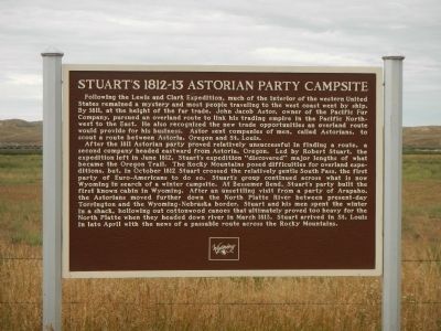
Stuartís 1812-13 Astorian Party Campsite
Inscription.
Following the Lewis and Clark Expedition, much of the interior of the western United States remained a mystery and most people traveling to the west coast went by ship. By 1811, at the height of the fur trade, John Jacob Astor, owner of the Pacific Fur Company, pursued an overland route to link his trading empire in the Pacific Northwest to the East. He also recognized the new trading opportunities an overland route would provide for his business. Astor sent companies of men, called Astorians, to scout a route between Astoria, Oregon and St. Louis.
After the 1811 Astorian party proved relatively unsuccessful in finding a route, a second company headed eastward from Astoria, Oregon. Led by Robert Stuart, the expedition left in June 1812. Stuartís expedition “discovered” major lengths of what became the Oregon Trail. The Rocky Mountains posed difficulties for overland expeditions, but, in October 1812 Stuart crossed the gentle South Pass, the first party of Euro-Americans to do so. Stuartís group continued across what is now Wyoming in search of a winter campsite. At Bessemer Bend, Stuartís party built the first known cabin in Wyoming. After an unsettling visit from a party of Arapaho, the Astorians moved further down the North Platte River between present-day Torrington and the Wyoming-Nebraska border. Stuart and his men spent the winter in a shack, hollowing out cottonwood canoes that ultimately proved too heavy for the North Platte when the headed down river in March 1813. Stuart arrived in St. Louis in late April with the news of a passable route across the Rocky Mountains.
Erected by Historical Landmark Commission of Wyoming.
Topics. This historical marker is listed in these topic lists: Exploration • Industry & Commerce. A significant historical month for this entry is March 1813.
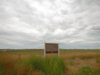
Location. 42° 1.851′ N, 104° 6.64′ W. Marker is near Torrington, Wyoming, in Goshen County. Marker is on U.S. 26 near Road 175, on the right when traveling west. Touch for map. Marker is in this post office area: Torrington WY 82240, United States of America. Touch for directions.
Other nearby markers. At least 8 other markers are within 5 miles of this marker, measured as the crow flies. The Oregon Trail (approx. 3Ĺ miles away); a different marker also named Oregon Trail (approx. 3.8 miles away); Cold Springs (approx. 3.8 miles away); Empire, Wyoming: African American Community Building in the West (approx. 3.9 miles away); a different marker also named Oregon Trail (approx. 3.9 miles away); Ben Trout Homestead Shack (approx. 4 miles away); Replica of the Statue of Liberty (approx. 4.4 miles away); CPL. Travis Snow Memorial Building (approx. 4Ĺ miles away). Touch for a list and map of all markers in Torrington.
Also see . . .
The Astorians Discover South Pass - Wyoming State Historical Society. In August 1812, one of the natives whose people had used South Pass to cross the Rocky Mountains for centuries mentioned this natural corridor to an American fur trader. And the history of this great pass, as well as that of the United States, was set on a course of change. (Submitted on December 17, 2014, by Barry Swackhamer of Brentwood, California.)
Credits. This page was last revised on September 26, 2020. It was originally submitted on December 17, 2014, by Barry Swackhamer of Brentwood, California. This page has been viewed 1,403 times since then and 47 times this year. Photos: 1, 2. submitted on December 17, 2014, by Barry Swackhamer of Brentwood, California. • Andrew Ruppenstein was the editor who published this page.

