Sterling in Cayuga County, New York — The American Northeast (Mid-Atlantic)
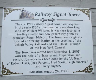
Railway Signal Tower
Photographed by Anton Schwarzmueller, November 7, 2014
1. Railway Signal Tower Marker
The c.a. 1910 Railway Signal Tower was acquired in the early 1930's then used as a woodworking shop by William Williams. It was then located in Sterling Center and now generously given by grandson Roger Malcott. The Tower was originally located at Sterling Station at the crossing of the Lehigh Valley Railroad and the "Hojack" division of the New York Central.
The tower was moved here December 6, 2005 with the help of a State grant. Preparation and restoration work has been done by the "A Team" of Robert Flack, Jack Preston, Jack Parsons, Fred Scott, Lehigh Shortslef and Harry Snyder. Dedication August 24, 2008.
Erected by Sterling Historical Society.
Topics. This historical marker is listed in these topic lists: Communications • Railroads & Streetcars. A significant historical month for this entry is December 1834.
Location. 43° 19.428′ N, 76° 38.772′ W. Marker is in Sterling, New York, in Cayuga County. It can be reached from New York State Route 104A 0.1 miles south of Williams Road. The marker, affixed to the tower, is set back from the road on the grounds of the Sterling Historical Society Museum. Touch for map.
this page online

Regionally, this marker is in Upstate New York, specifically in Central New York, and in the Syracuse Metropolitan Area. It is also in the American Northeast and in the Mid-Atlantic. Globally, it is in North America, the Western Hemisphere, the Western World, and the Anglosphere. Historically, it finds itself in what was once the Haudenosaunee (Iroquois) Confederacy, New Netherland, and one of the original Thirteen Colonies.
Other nearby markers. At least 8 other markers are within 3 miles of this marker, measured as the crow flies: School House Built 1825 (within shouting distance of this marker); District School # 5 (within shouting distance of this marker); Town of Sterling (about 600 feet away, measured in a direct line); Site of First Baptist Church of Sterling (approx. 0.2 miles away); Patriot Burials (approx. ¼ mile away); Sterling Valley (approx. 1.9 miles away); Dutch Reformed (approx. 2.7 miles away); Presbyterian (approx. 2.9 miles away). Touch for a list and map of all markers
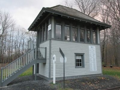
Photographed by Anton Schwarzmueller, November 7, 2014
2. South Side of Tower
Marker is behind the metal post.
Also see . . .
1. Rome, Watertown and Ogdensburg Railroad - Wikipedia. The "Hojack" line. (Submitted on December 20, 2014, by Anton Schwarzmueller of Wilson, New York.)
2. Sterling Historical Society. (Submitted on December 20, 2014, by Anton Schwarzmueller of Wilson, New York.)
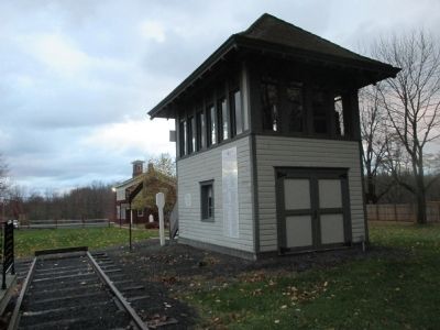
Photographed by Anton Schwarzmueller, November 7, 2014
3. East Side. View Towards NY 104A
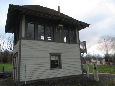
Photographed by Anton Schwarzmueller, November 7, 2014
4. North Side
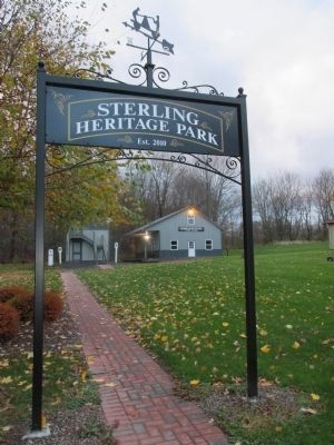
Photographed by Anton Schwarzmueller, November 7, 2014
5. Walkway to Railway Signal Tower & Marker
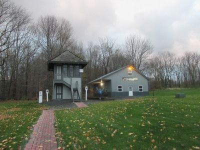
Photographed by Anton Schwarzmueller, November 7, 2014
6. Railway Signal Tower
Credits. This page was last revised on April 11, 2024. It was originally submitted on December 20, 2014, by Anton Schwarzmueller of Wilson, New York. This page has been viewed 1,119 times since then and 43 times this year. Photos: 1, 2, 3, 4, 5, 6. submitted on December 20, 2014, by Anton Schwarzmueller of Wilson, New York. • Bill Pfingsten was the editor who published this page.
