Alameda in Alameda County, California — The American West (Pacific Coastal)
Alameda City Hall, 1895-96
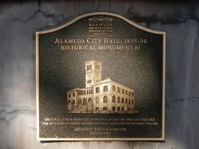
Photographed by Barry Swackhamer, December 3, 2014
1. Alameda City Hall, 1895-96 Marker
Erected 2014 by Alameda Architectural Preservation Society. (Marker Number 1.)
Topics. This historical marker is listed in this topic list: Government & Politics. A significant historical year for this entry is 1906.
Location. 37° 45.978′ N, 122° 14.619′ W. Marker is in Alameda, California, in Alameda County. It is on Santa Clara Avenue near Oak Street, on the right when traveling west. Touch for map. Marker is at or near this postal address: 2275 Santa Clara Avenue, Alameda CA 94501, United States of America. Touch for directions.

Regionally, this marker is in the San Francisco Bay Area and on the Coast Ranges. It is also on the American Pacific Coast. Globally, it is in North America, on the Ring of Fire, on the Pacific Rim, in the Western Hemisphere, in the Western World, and in the Anglosphere. Historically, it finds itself in what was once New Spain and also Mexico’s Alta California.
Other nearby markers. At least 8 other markers are within walking
this page online
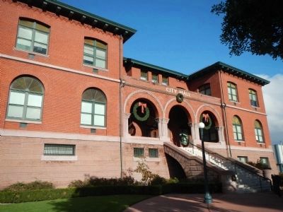
Photographed by Barry Swackhamer, December 3, 2014
2. Alameda City Hall, 1895-96 Marker
This marker is at the bottom of the stairs, on the left.
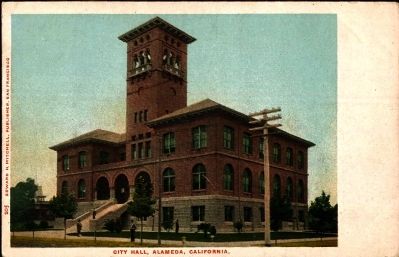
Postcard by Edward H. Mitchell, Publisher, circa 1905
3. City Hall, Alameda, California.
Credits. This page was last revised on February 18, 2021. It was originally submitted on December 24, 2014, by Barry Swackhamer of Brentwood, California. This page has been viewed 865 times since then and 40 times this year. Photos: 1, 2. submitted on December 24, 2014, by Barry Swackhamer of Brentwood, California. 3. submitted on January 4, 2015. • Andrew Ruppenstein was the editor who published this page.
