Near Julesburg in Sedgwick County, Colorado — The American Mountains (Southwest)
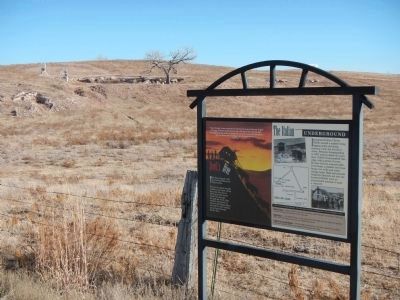
Devilís Dive / The Italian Underground
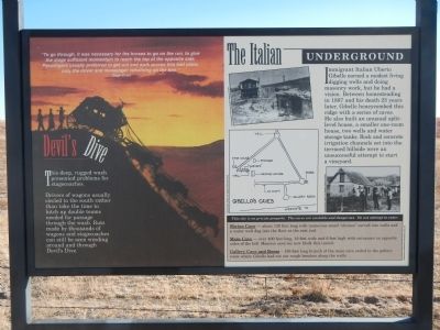
This deep, rugged wash presented problems for stagecoaches.
Drivers of wagons usually circled to the south rather than take the time to hitch up double teams needed for passage through the wash. Ruts made by thousands of wagons and stagecoaches can still b seen winding around and through Devilís Dive.
“To go through, it was necessary for the horses to go on the run, to give the stage sufficient momentum to reach the top of the opposite side. Passengers usually preferred to get out and walk across this bad place, only the driver and messenger remained on the box.” - Stage Driver
The Italian Underground
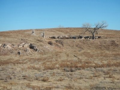
Immigrant Italian Uberto Gibello earned a modest living digging wells and doing masonry work, but he had a vision. Between homesteading in 1887 and his death 23 years later, Gibello honeycombed this ridge with a series of caves. He also built an unusual split-level home, two wells and water storage tanks. Rock and concrete irrigation channels set into the terrace hillside were an unsuccessful attempt to start a vineyard.
This site is on private property. The caves are unstable and dangerous. Do not attempt to enter.
Shrine Cave - about 120 feet long with numerous small “shrines” carved into walls and a water well dug into the floor at the east end. be Main Cave- over 400 feet long, 10 feet wide and 6 feet high with entrances on opposite sides of the hill. Massive cave-ins now block the tunnel.
Gallery Cave and Room - 150-foot long branch of the main cave ended in the gallery where Gibello had cut out rough benches along the walls.
Topics. This historical marker is listed in these topic lists: Roads & Vehicles • Settlements & Settlers. A significant historical year for this entry is 1887.
Location. 40° 57.488′ N, 102° 15.893′ W. Marker is near Julesburg, Colorado, in Sedgwick County. Marker is on County Route 28, on the left when traveling west. Touch for map. Marker is at or near this postal address: 2000 County Road 28, Julesburg CO 80737, United States of America. Touch for directions.
Other nearby markers. At least 8 other markers are within 2 miles of this marker, measured as the crow flies. Last Days of the Buffalo (approx. 0.9 miles away); Colorado's Wildlife Story (approx. 0.9 miles away); Welcome to Colorado (approx. 0.9 miles away); The Pony Express Trail (approx. 0.9 miles away); Overland City (Julesburg) Pony Express Riders (approx. 0.9 miles away); Prairie Home Companions (approx. 1.3 miles away); The Town that Wouldn't Die (approx. 1.9 miles away); Fourth Julesburg (approx. 1.9 miles away). Touch for a list and map of all markers in Julesburg.
More about this marker. This marker is 0.9 miles west of the Colorado Welcome Center.
Also see . . . Pride and Pioneers - En Compass (AAA). The South Platte River Trails offers a path to Northeast Colorado's colorful past. (Submitted on December 24, 2014, by Barry Swackhamer of Brentwood, California.)
Credits. This page was last revised on June 16, 2016. It was originally submitted on December 24, 2014, by Barry Swackhamer of Brentwood, California. This page has been viewed 1,549 times since then and 128 times this year. Photos: 1, 2, 3. submitted on December 24, 2014, by Barry Swackhamer of Brentwood, California. • Andrew Ruppenstein was the editor who published this page.


