Crossville in DeKalb County, Alabama — The American South (East South Central)
Town of Crossville
Photographed by David J Gaines, December 26, 2014
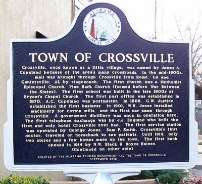
1. Town of Crossville Marker, front
(front)
Crossville, once known as a little village, was named by James A. Copeland because of the area’s many crossroads. In the mid-1800s, mail was brought through Crossville from Rome, GA and Guntersville, AL by stagecoach. The first church was a Methodist Episcopal Church, Pine Bark Church (formed before War Between the States). The first school was built in the late 1800s at Bryant’s Chapel Church. The first post office was established in 1870. A.C. Copeland was postmaster. In 1888, G.W. Justice established the first business. In 1901, W.B. Jones installed machinery for cotton mills, and the first car came through Crossville. A government distillery was once in operation here. The first telephone exchange was by J.J. England who built the first and only hotel Crossville ever had. The first service station was operated by George Jones. Sam P. Smith, Crossville’s first doctor, traveled on horseback to see patients. Until 1914, only two stores and a few homes made up the town. The first bank opened in 1914 by N.W. Black & Boyce Raines.
this page online
Erected 2010 by Alabama Tourism Department and the Town of Crossville.
Topics and series. This historical marker is listed in this topic list: Settlements & Settlers. In addition, it is included in the Alabama Tourism Department series list. A significant historical month for this entry is July 1865.
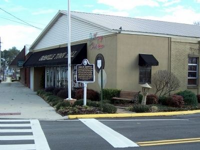
Location. 34° 17.239′ N, 85° 59.566′ W. Marker is in Crossville, Alabama, in DeKalb County. It is at the intersection of Main Street (Alabama Route 68) and Gaines Street, on the right when traveling east on Main Street. It is located
Photographed by David J Gaines, December 26, 2014
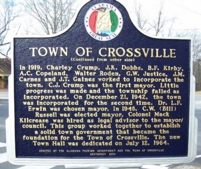
2. Town of Crossville Marker, rear

Regionally, this marker is in North Alabama. It is also in the American South, specifically in the Deep South, in Appalachia, and specifically in Southern Appalachia. Globally, it is in North America, a Gulf of Mexico state, the Western Hemisphere, the Western World, and the Anglosphere. Historically, it finds itself in what was once the original Cherokee Nation, the territory of the Mississippian Culture, one of the Confederate States of America, and the Antebellum South.
Other nearby markers. At least 8 other markers are within 12 miles of this marker, measured as the crow flies: Town of Geraldine: Home of the Bulldogs (approx. 5.2 miles away); Indian Mound, Inn, and Church Site (approx. 7.6 miles away); Collinsville Historic District (approx. 7.6 miles away); Fires and Floods (approx. 7.8 miles away); Old Bethel United Primitive Baptist Church and Cemetery (approx. 9.2 miles away); William Lewis Moore (approx. 10 miles away); Sardis City Beginnings (approx. 10.7 miles
Photographed by David J Gaines, December 26, 2014
3. Town of Crossville Marker
Credits. This page was last revised on June 16, 2016. It was originally submitted on December 26, 2014, by David J Gaines of Pinson, Alabama. This page has been viewed 1,328 times since then and 103 times this year. Photos: 1, 2, 3. submitted on December 26, 2014, by David J Gaines of Pinson, Alabama. • Bernard Fisher was the editor who published this page.
